


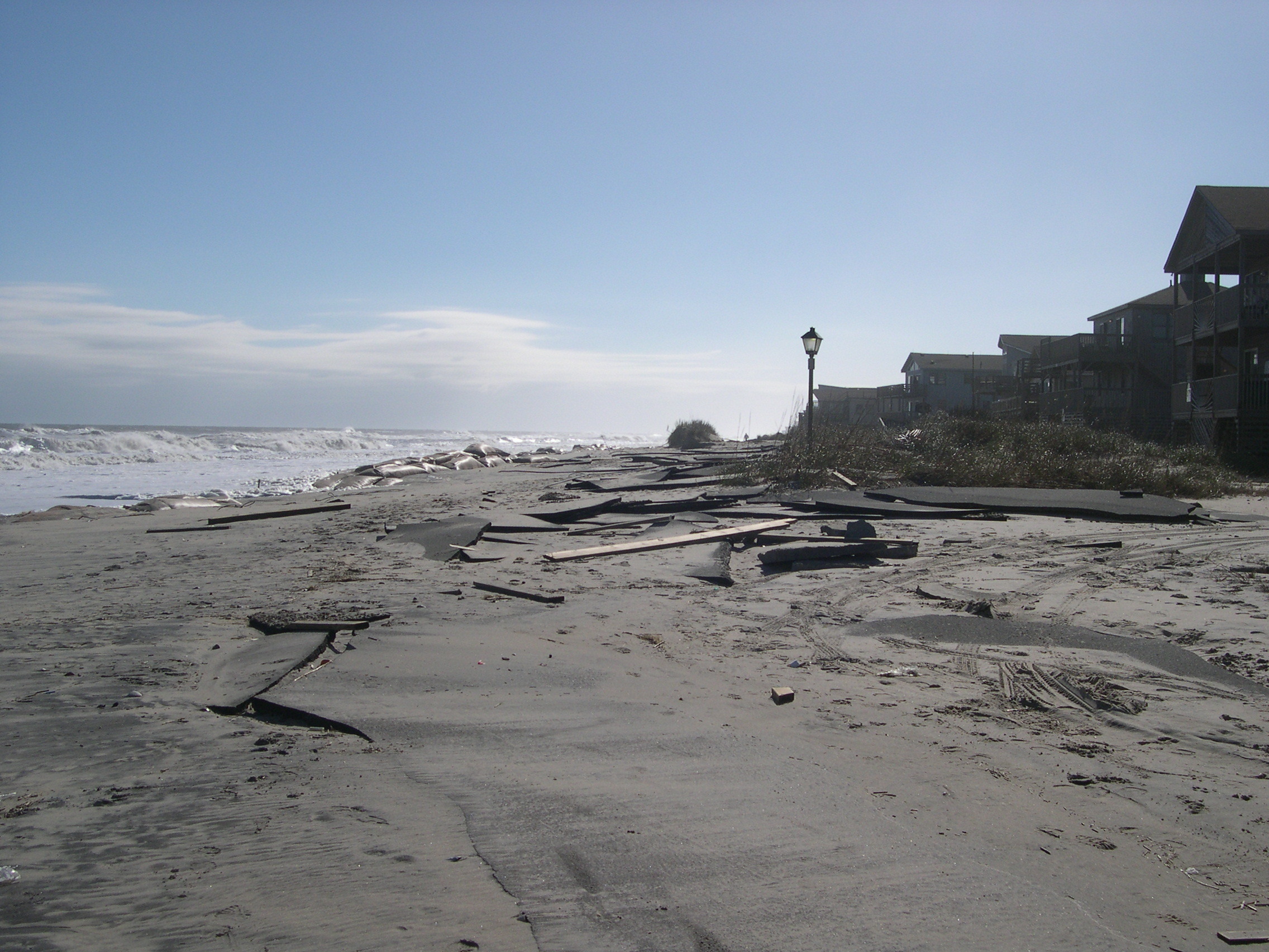
Destruction following a storm in Nags Head, North Carolina, in November 2006.
A scene from Nags Head, North Carolina, during a storm in November 2006.
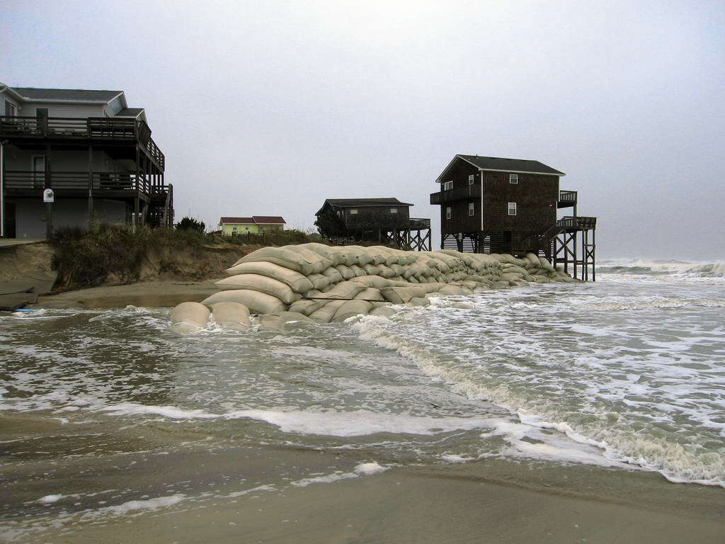
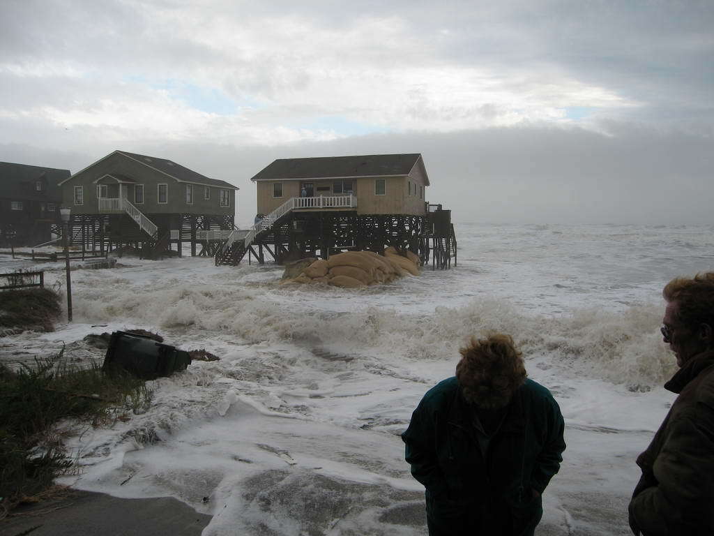
A scene from Nags Head, North Carolina, following a storm in November 2009.
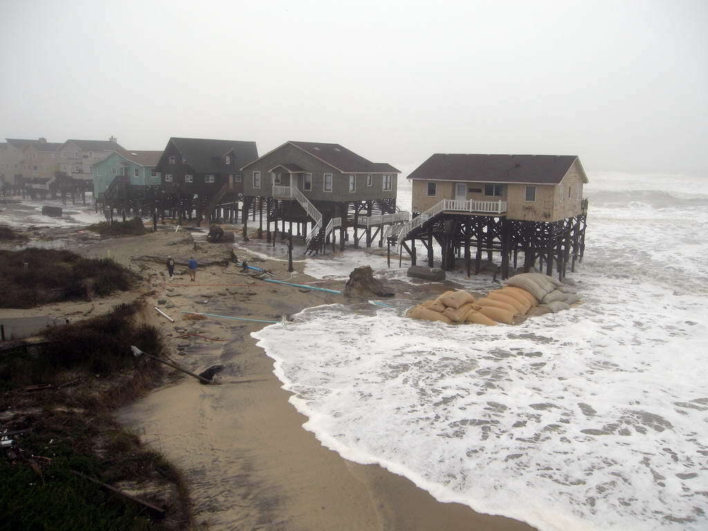
A scene from Nags Head, North Carolina, following a storm in November 2009.
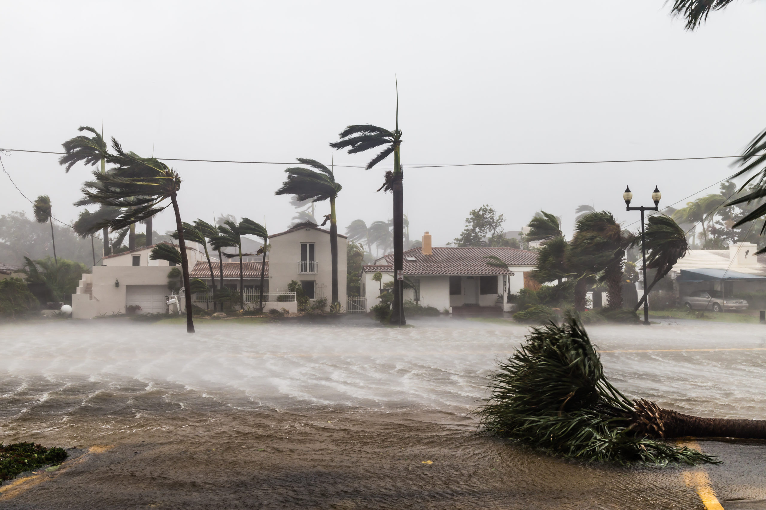
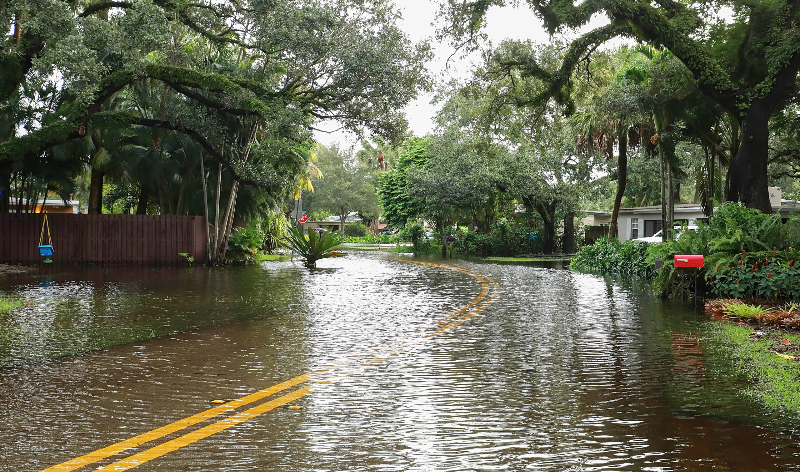
Flooded Las Olas Boulevard in Fort Lauderdale, Florida, during Hurricane Irma in 2017.
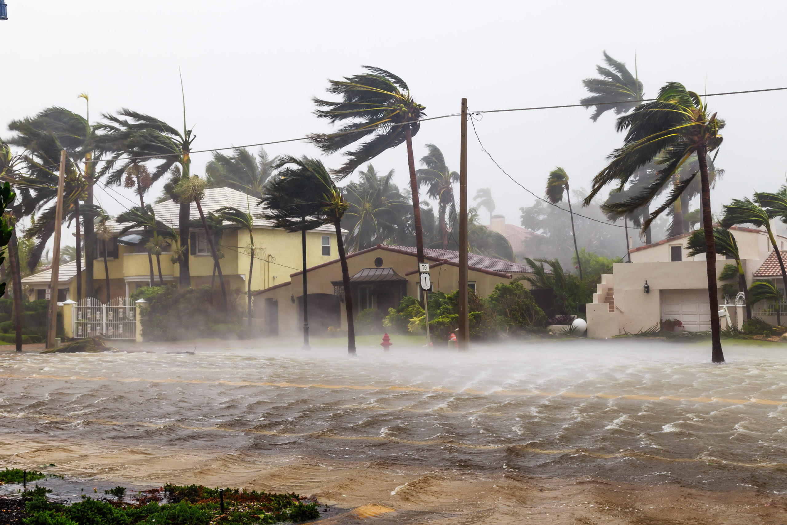
Flooded Las Olas Boulevard in Fort Lauderdale, Florida, during Hurricane Irma in 2017.
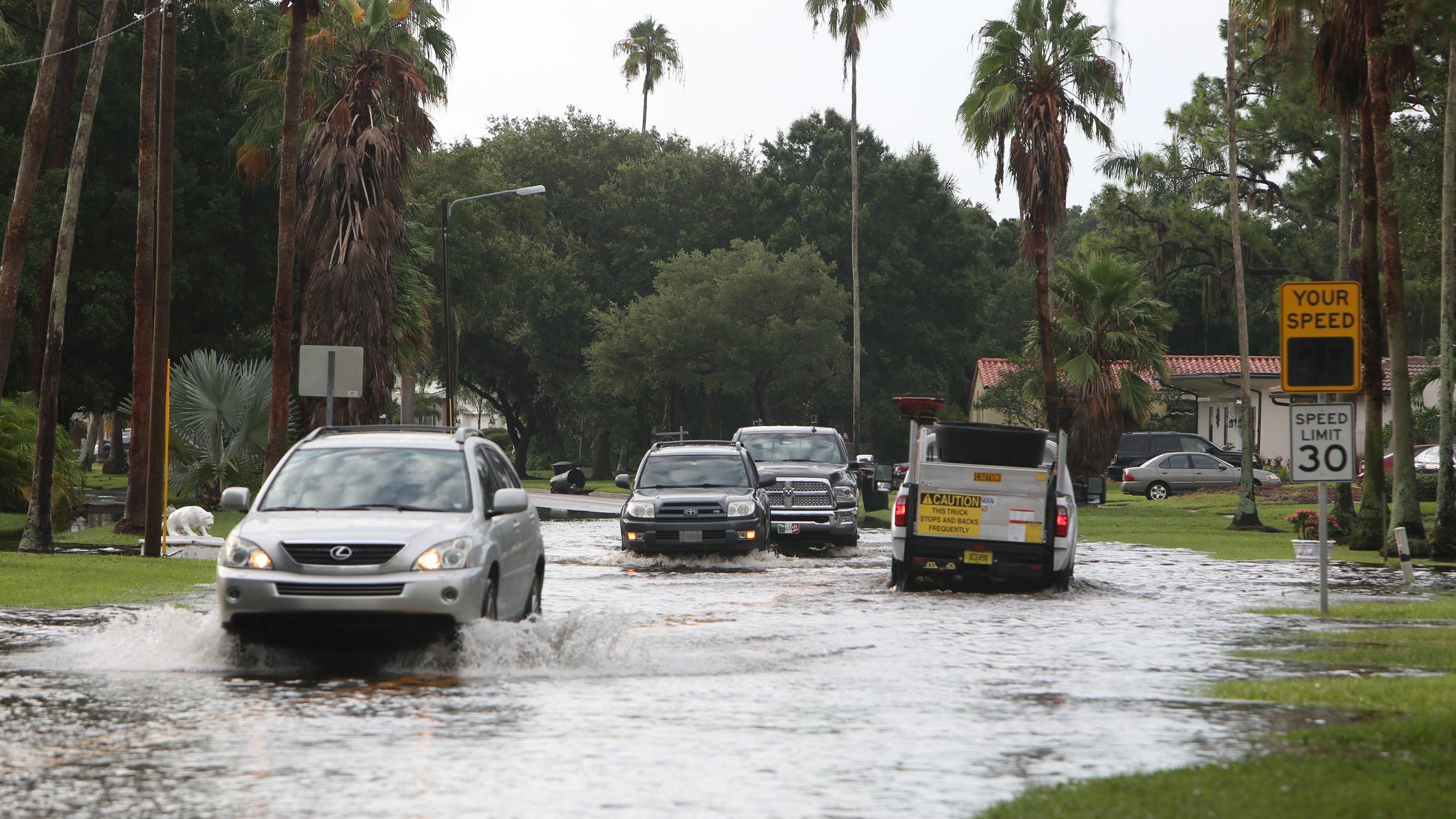
A flooded Snell Isle Boulevard in Saint Petersburg, Florida, in 2015.
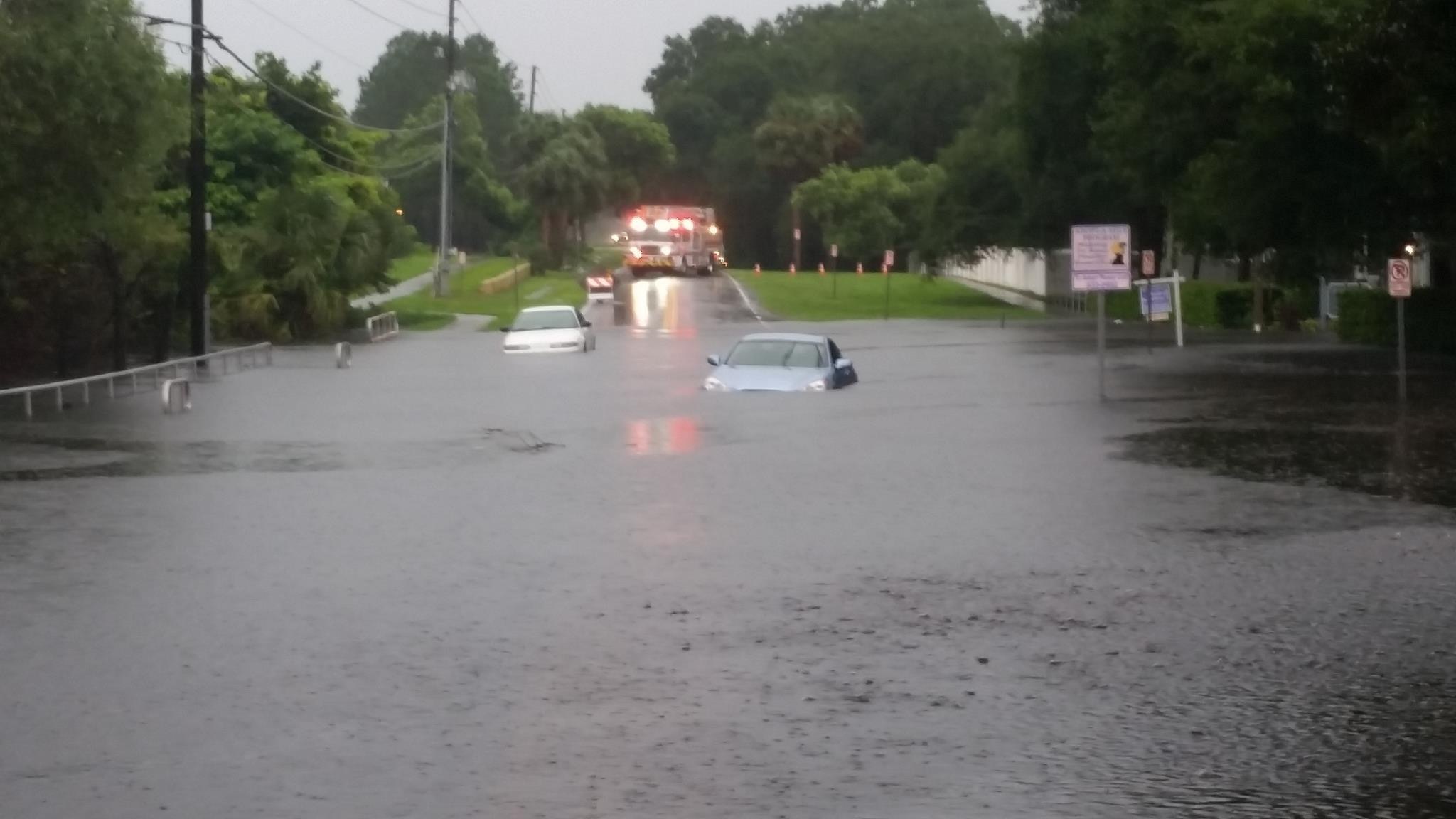
A flooded street in Pinellas County, Florida.
Water from Tropical Storm Eta flooded a street in Fort Lauderdale, Florida, in 2020.
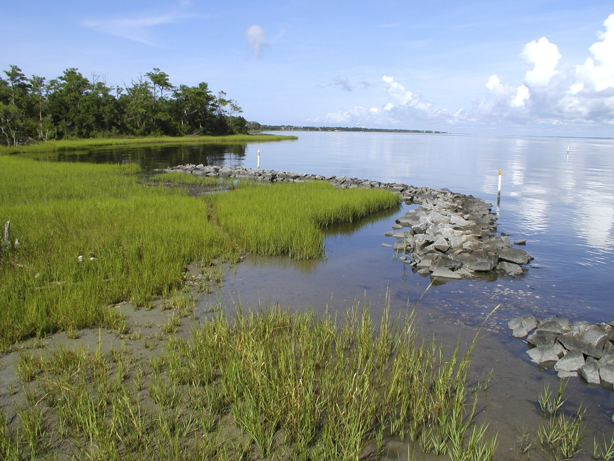
A living shoreline in Pinellas County, Florida.

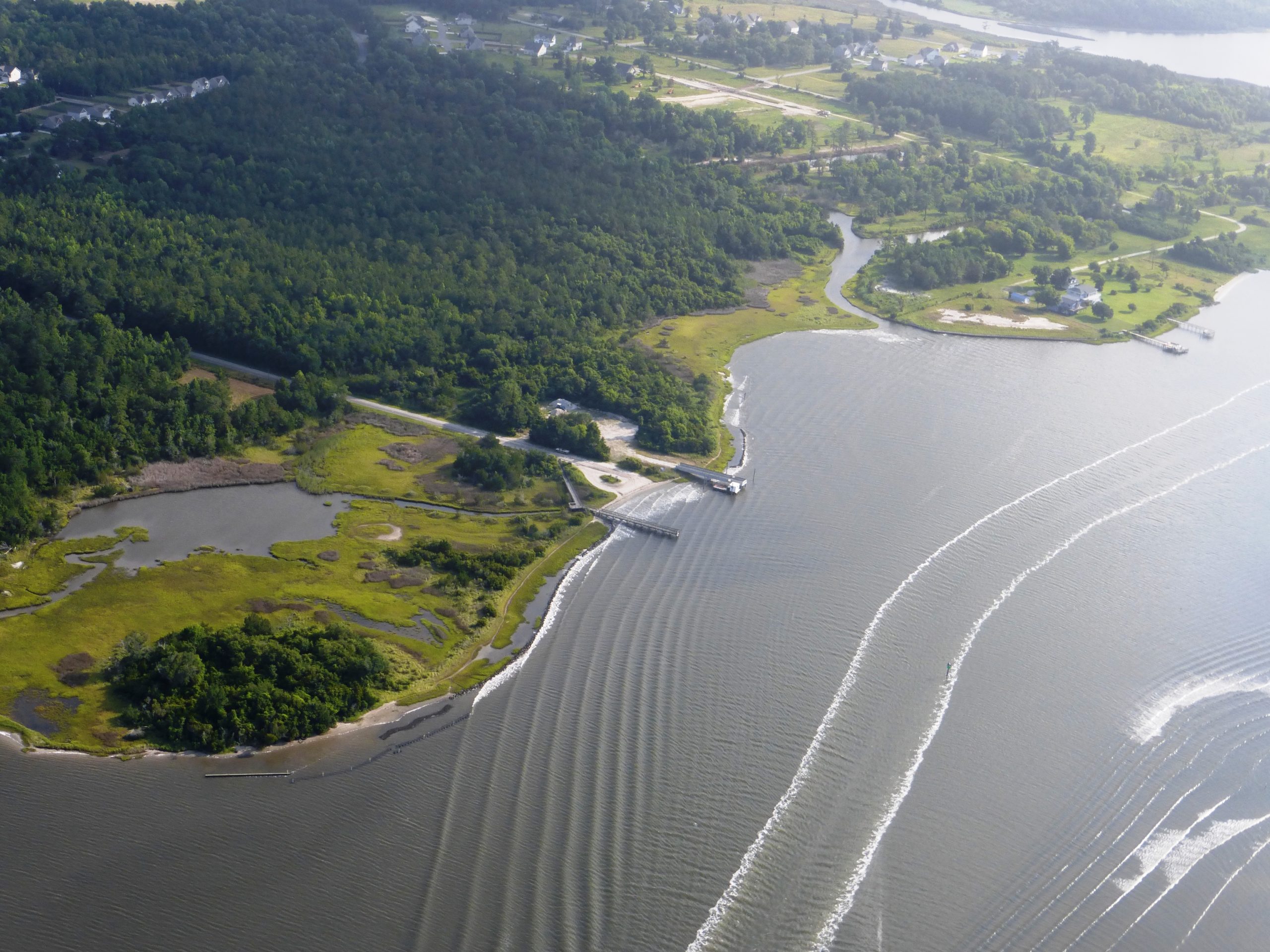
An aerial view of homes close to the water in Pinellas County, Florida.
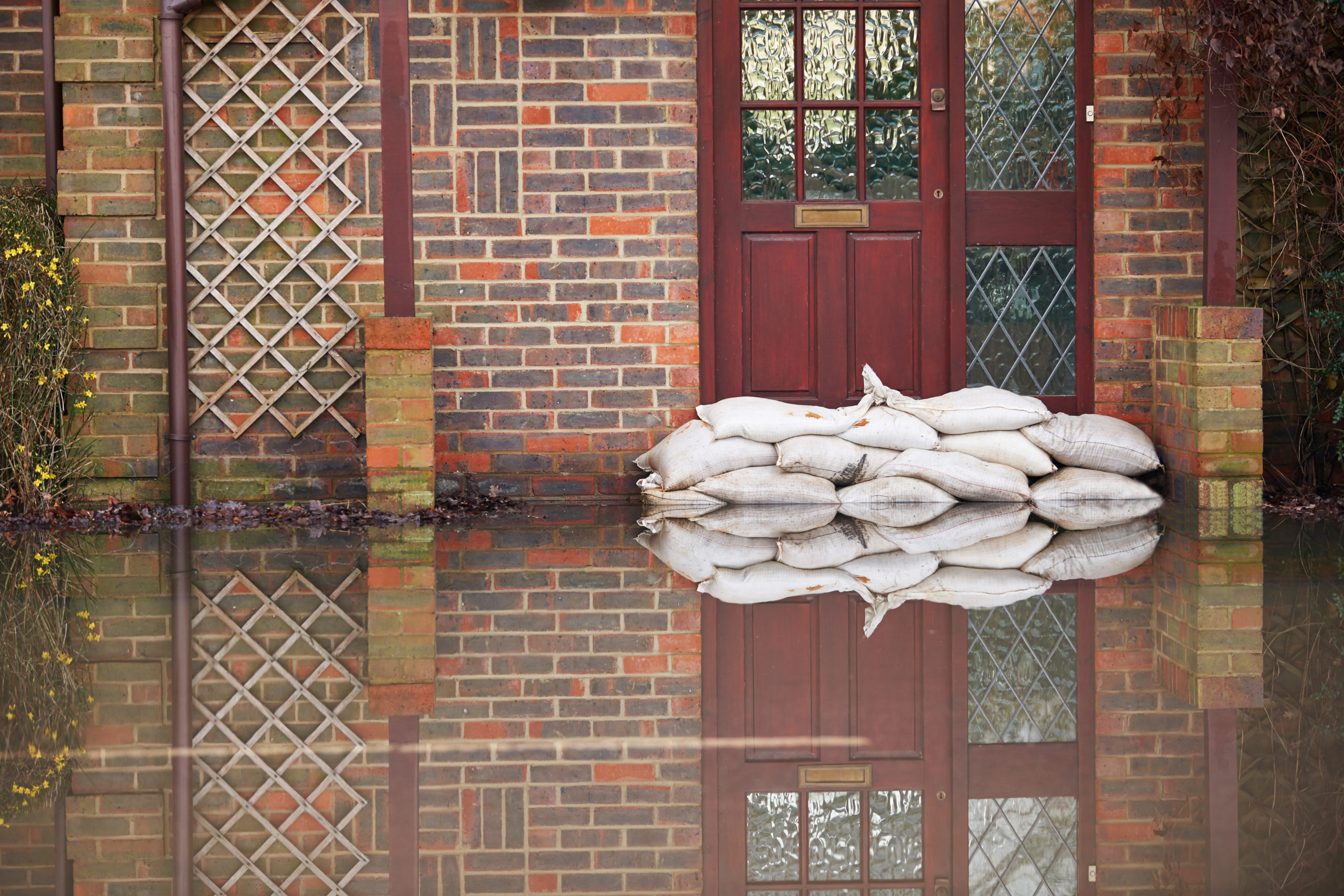
Sandbags outside of the front door of a flooded house.
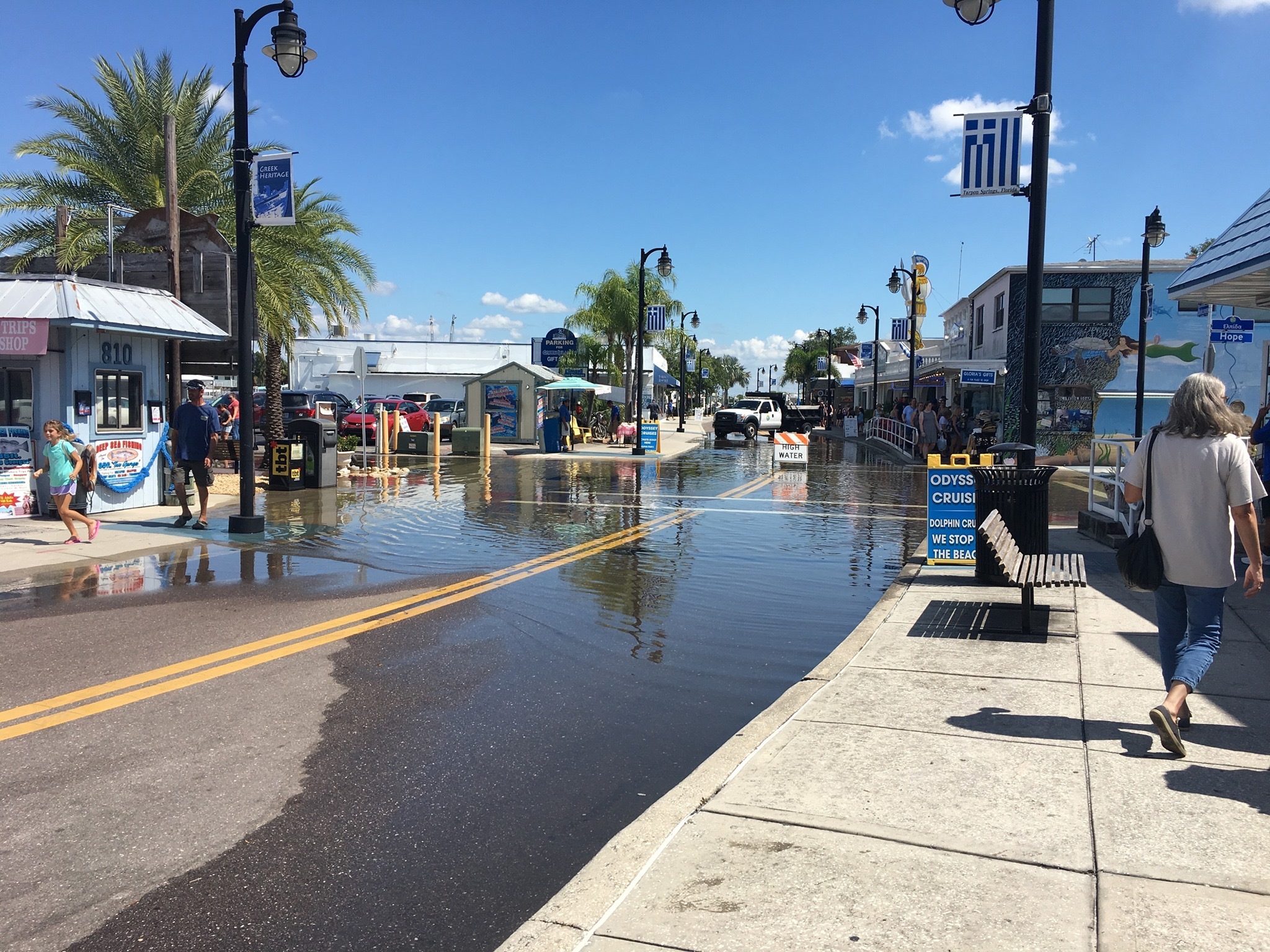
Flooding in downtown Tarpon Springs, Florida, in 2017.
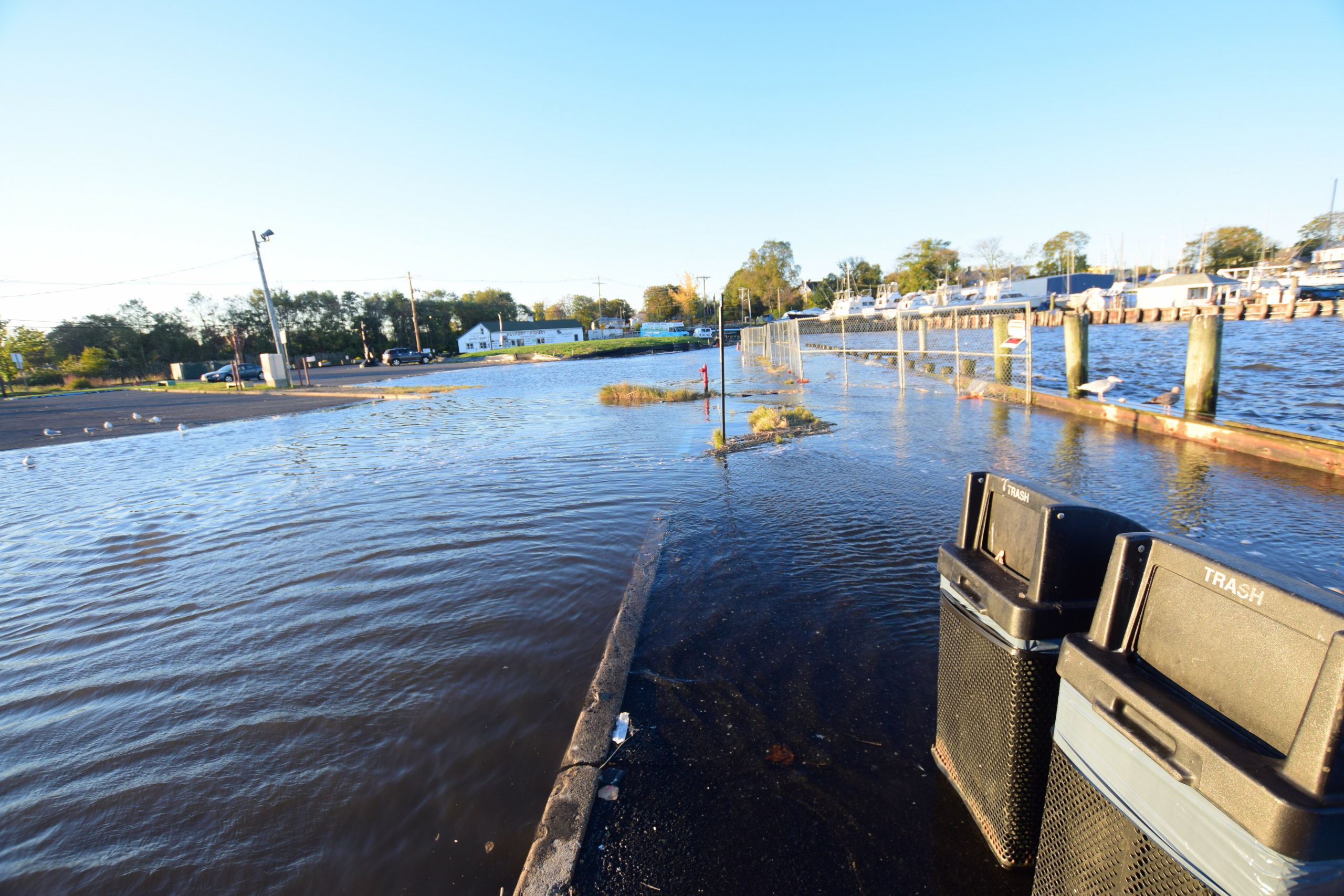
Flooding in Keyport, New Jersey, in November 2021.
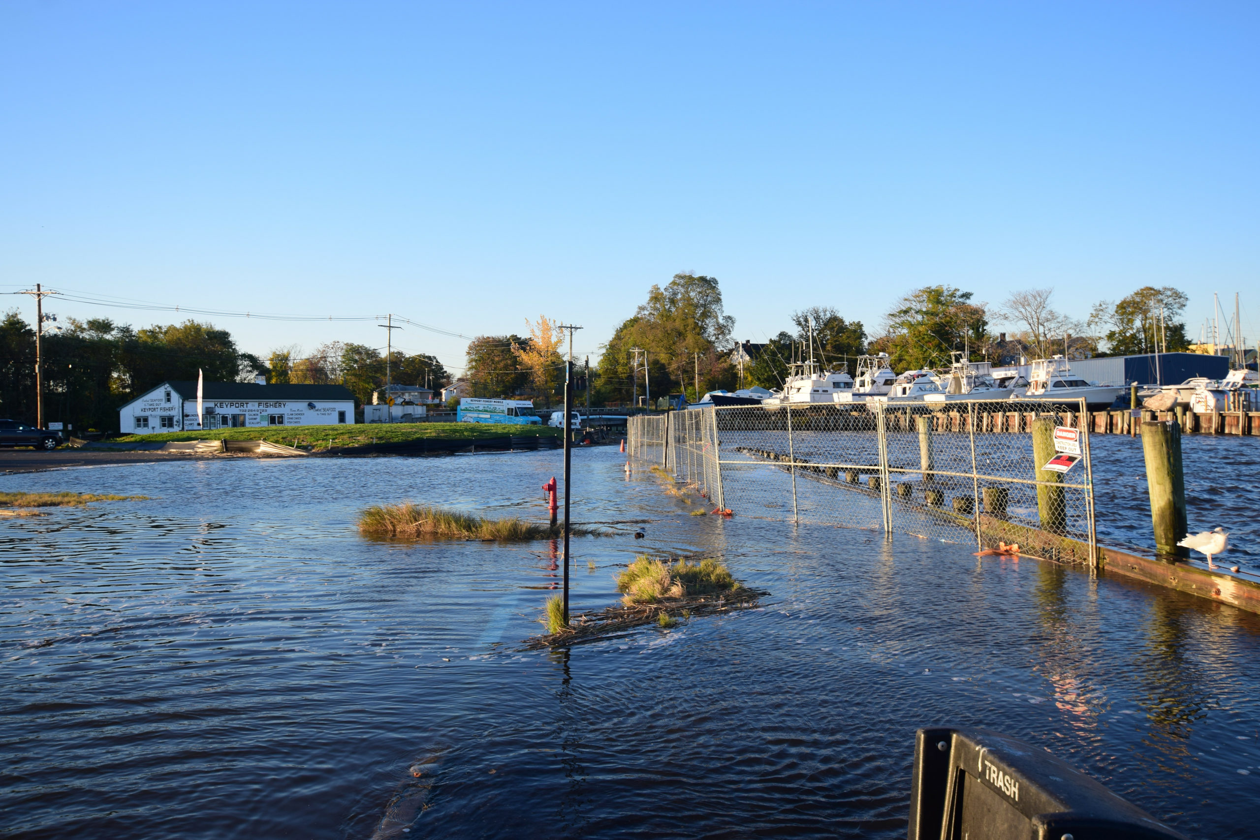
Flooding in Keyport, New Jersey, in November 2021.
Flooding in Keyport, New Jersey, in November 2021.
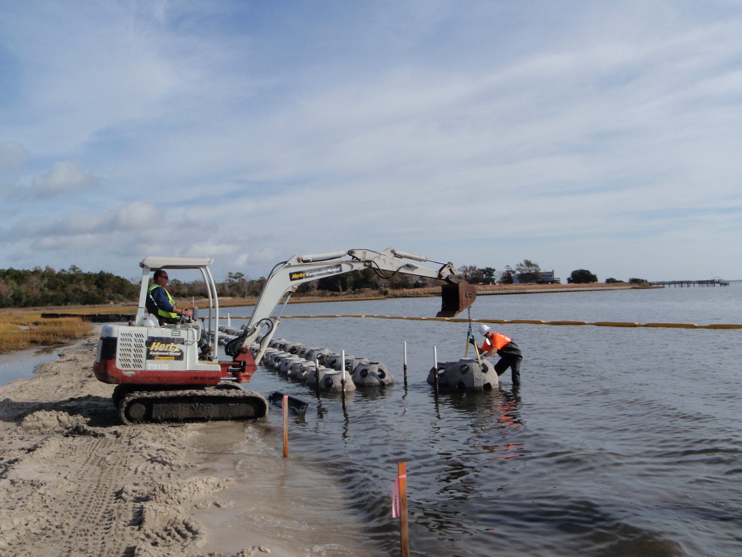
A 150-foot section of concrete oyster domes serves as the base for a newly constructed living shoreline, adding to the large shoreline and marsh restoration project at Morris Landing across from North Topsail Beach.
A 150-foot section of concrete oyster domes serves as the base for a newly constructed living shoreline, adding to the large shoreline and marsh restoration project at Morris Landing across from North Topsail Beach.
“It’s really easy to destroy things. And it’s really difficult to bring them back.”
— Noaki Schwartz, California Coastal Commission
As the debates over beach nourishment, shoreline armoring and managed retreat create a deafening din in coastal communities, a report by researchers from the National Oceanic and Atmospheric Administration landed last week with an even louder thud.
In the next 30 years, the United States is expected to see as much sea level rise as it has over the last century, the report says. For many coastal communities, that means the water will come up 10 inches to 1 foot, on average, by 2050 — and, by 2100, up to 7 feet, though the report noted that these long-term estimates are less certain.
“This new data on sea rise is the latest reconfirmation that our climate crisis — as the president has said — is blinking ‘Code Red,’” National Climate Advisor Gina McCarthy said in a press release. “We must redouble our efforts to cut the greenhouse gases that cause climate change while, at the same time, help our coastal communities become more resilient in the face of rising seas.”
The 111-page technical report is the latest product of the Interagency Sea Level Rise and Coastal Flood Hazard and Tool Task Force that, outside of NOAA, includes members from NASA, the U.S. Environmental Protection Agency, and the federal departments of Homeland Security and Defense, among others.
Outside of offering sea level rise projections, this multi-agency effort — which updates a 2017 study with a better understanding of the impact of global warming on the Greenland and Antarctic ice sheets, as well as improved computer modeling — also provides information to help communities assess potential changes in average tide heights as they strive to adapt.
“We have to accommodate to nature, not nature accommodate to us. It’s the big lesson of this century,” said Anjuli Ramos-Busot, director of the Sierra Club New Jersey chapter. “We cannot continue to try to manipulate nature into nature molding toward us — it just doesn’t work. We have to mitigate as much as we can by understanding how things are going to change.”
In the first installment of the Express News Group’s “Rising Tide” series, government officials and environmentalists from East Hampton and Southampton towns weighed in on the impacts of climate change across the East End — illustrated by sea level rise and fast-eroding beaches, shrinking shorelines and sunny day flooding, an elevated water table, and declining water quality.
Up and down the Eastern Seaboard, coastal communities paint a very similar picture — each combating a unique set of challenges with temporary fixes, many without regional guidance or a clear answer on what to do next.
“The clock is ticking,” said Brian Baer, executive director of The Elevated Studio, a nonprofit disaster recovery firm based in Beacon, New York. “I’m not entirely sure if there is a large enough, unfortunately, political will across the country to really recognize that there is a problem — and the only way to get through this problem is to solve it collectively and collaboratively.”
Nearly 100 years ago, the Coney Island Public Beach and Boardwalk Improvement of 1923 marked the first-ever beach nourishment project in the United States, which transformed about two miles of shoreline dotted with “ramshackle” development and narrow to nonexistent beaches into “a world-famous resort that was accessible to all for no more than the cost of a subway fare,” according to the American Society of Civil Engineers Library.
More than 450 beach communities have followed suit in the century since. Over 1.5 billion cubic yards of sand have restored and maintained beaches across the country in an attempt to protect the shores and expand the beaches. The majority were nourished many times over, totaling about 3,200 separate projects, the Journal of Ocean & Coastal Management reported, with the widely held knowledge that these are short-term fixes with a replenishment cycle, rather than long-term remedies.
“It’s a temporary solution, because we’ve seen this sand just being flushed away by the next storm,” Ramos-Busot said. “It’s a temporary fix — it’s not looking holistically at the whole situation with climate change and sea level rise — and it’s town by town. You’re just not looking at the region, which is what we should be doing.
“If it were up to me, I wouldn’t even be dealing with this on a state-by-state basis,” she continued. “I would really just do the entire East Coast — or at least where it makes sense, in terms of ocean patterns.”
In North Carolina, the town of North Topsail Beach sits on a 26-mile-long barrier island alongside two adjacent coastal communities, each famous for their pristine beaches and marshes. “Our motto is, ‘Nature’s tranquil beauty,’” Alderman and Mayor Pro Tem Mike Benson said.
As part of the island’s longshore current, sand naturally moves from North Topsail Beach, which comprises 11 miles, to the regions farther south, he explained. The town took out a $16 million loan to replenish 1.2 million cubic yards of sand on four miles of its beach in 2015.
But, six years later, that same stretch needs sand again — and the town recently pulled out of a joint federal project, in partnership with adjacent Surf City, that would have given it to them. “We just couldn’t afford it,” Benson said.
In 2010, the U.S. Army Corps of Engineers estimated that the Coastal Storm Risk Management Project, which planned to dump 14 million cubic yards of sand across 10 miles between the two towns, would cost $123.1 million initially and $227.8 million for continued nourishment over 50 years. A decade later, the cost had risen to $237 million and $672.1 million, respectively.
For perspective, North Topsail Beach operates on an approximately $6 million annual budget, Benson said.
“We were going to have to come up with around $34 million to be able to participate in it — and we just don’t have those kinds of funds,” he said. “And we’re still trying to recover from a previous beach nourishment project that the town took on in 2015. We’re still paying that loan off. In that regard, we just couldn’t go in debt that much more, because our property values, our revenues, just can’t support that kind of a project.”
About 200 miles north, Nags Head in North Carolina funded a $37 million beach nourishment project in 2011 that pumped 4.6 million cubic yards of sand across 10 miles of oceanfront — the first of its kind for the Outer Banks region — funded solely by the town and Dare County, according to Mayor Ben Cahoon.
“We’ve never gotten federal funding for beach nourishment, nor state funding,” he said. “So ours is the largest locally funded beach nourishment project in the country.”
Dare County’s beach nourishment fund and Nags Head split the cost of the project — about $18 million each — which they paid back over six years with proceeds from a 1 percent increase to the county occupancy tax and an increase in town property taxes: 2 cents per $100 of valuation townwide, and 16 cents per $100 of valuation for the oceanside. For example, a waterfront home valued at $3 million would have contributed $5,400 annually to beach nourishment.
“This is what people are really surprised by: In almost any other place, if you imagined adding an overlay district where you’re going to tax people more money, people would come out to the board meetings screaming bloody murder, ready to tar and feather you,” Cahoon said, “and we got one person to speak who was in favor of it — and nobody to speak against it.”
Prior to the initial nourishment in 2011, Nags Head was losing homes, streets and waterlines not only to hurricanes but also during typically less impactful storms. Today, it is unusual to even have any type of ocean overwash in the town, Cahoon said.
“There are very few taxes that you pay that you see the direct benefit of them — and when they pay beach nourishment taxes, they know it only goes to one thing,” he said. “When they see that dredge show up in the ocean, and they see the pipe and they see the sand spraying out of the pipe, and they see the bulldozers make their beach three times as wide as it was, and they see that money actually going on the beach, they don’t argue with it.
“They know our entire economy hangs on the beach,” he continued, “so they have no concern about paying for it.”
This summer, Nags Head will launch a Hurricane Dorian restoration project to place 567,000 cubic yards of sand on nearly 4½ miles of beach and added four more tax districts in order to “establish a more sustainable funding plan,” according to a press release. The nearly $14 million project will be mostly funded by two grants, with just shy of $450,000 coming from the town’s beach nourishment capital reserve. A regularly scheduled beach nourishment of other northern beaches is tentatively planned for 2027.
Cahoon said he considers the effort to be a success — “We have a healthy beach. We have a healthy dune system,” he said — and the largest issue, he reported, is fine sand grains blowing into swimming pools and piling up on decks.
“I just talked to an oceanfront owner yesterday morning at the coffee shop who said, ‘I’ve got so much sand, I’m gonna have to pay somebody to come move it,’” he recalled, “and held their hands up and said, ‘But, I’d rather have that problem than the erosion problem.’”
In Pinellas County, Florida, the next cycle of the Sand Key Shore Protection Project — which has totaled 9.3 million cubic yards of sand and cost $139.7 million since its first installment in 1988 — is stalled by a technicality: easements. To be more specific, 461 of them.
Until they are all signed, the Army Corps will skip each new cycle of the federal-, state- and county-funded project — the next one set to begin in 2024, explained Hank Hodde, sustainability and resiliency program coordinator for Pinellas County.
“The renourishment of Sand Key is a need, it’s a problem,” he said, “but it’s not the only one that we have.”
With 1 million residents packed onto its peninsula, Pinellas County is the densest county in the state, he explained, and 25 percent of it is categorized as a coastal high hazard area. Flood projections show an increase of up to 40 percent of the county, Hodde said.
“It’s graphically alarming right now, when you look at the extent of potential inundation,” he said, “and then think about the amount of pieces of the community puzzle that need to be considered and potentially altered to adapt.”
According to the recent NOAA report, sea level rise will create a profound shift in coastal flooding over the next 30 years by causing tide and storm surge heights to increase and reach farther inland. By 2050, “moderate,” or typically damaging, flooding is expected to occur, on average, more than 10 times as often as it does today.
“We’re trying to get there, but there’s no road map for this. We’re just figuring it out on the fly,” Hodde said. “We look toward different entities to get guidance, but it’s hard to follow some procedural road map from a local government, because every local government is different, every geography is different.”
In 1969, when an estimated 3 million gallons of crude oil spilled into the Santa Barbara Channel, creating an oil slick 35 miles long along California’s coast that killed thousands of fish, birds and sea mammals, the region quickly became the breeding ground for some of the most substantial conservation efforts of the 20th century.
The spill galvanized citizen-led environmental groups, who quickly noticed increased private development cutting off public access to the shore. They rallied to “Save Our Coast,” pushing for new laws and regulations — and, by 1972, they had them.
Proposition 20, a voter initiative, ultimately led to the passage of the California Coastal Act of 1976 — which has been called the most stringent environmental law in the country — and the establishment of the California Coastal Commission, an independent, quasi-judicial state agency whose job is to regulate development, ensure that it is consistent with the Coastal Act and, above all else, preserve public access.
“We really consider the coast and our beaches as our public park,” explained Noaki Schwartz, public information officer for the California Coastal Commission. “Public access to the coast is written into the state constitution. It’s built into our DNA that we’ll have access to the coast.”
The commission has planning, regulatory and permitting responsibilities, in partnership with local governments, over all development within the coastal zone, a 1.5 million-acre area stretching 1,100 miles along the state’s coastline from Oregon to Mexico, and around nine offshore islands.
With topography ranging from craggy bluffs to soft-sand beaches, there is no one-size-fits-all approach to coastal development, explained California Coastal Commission Chair Donne Brownsey. A number of broad principles must apply, though, including protection of public safety and views, coastal agriculture, environmentally sensitive habitat areas, and new and existing structures from hazards — which, as of last year, includes sea level rise.
And only owners of structures built prior to the passage of the Coastal Act can make the case for hardening the coast in front of them.
“For new construction, we require that those permits and those projects accept that they have no right to shoreline armoring,” Brownsey said, “because we analyze everything that comes before us, in terms of the impact that it will have on the beaches and bluffs. And we know that hard shoreline armoring — i.e. sea walls, revetments, etc. — accelerate the erosion of beaches.”
As the impacts of sea level rise worsen, the chair said she expects this discussion to become a “more intense debate as we go forward,” while some states, like North Carolina, have banned shoreline armoring structures altogether.
“We cannot build jetties, groins, sea walls, anything, they’re not permitted — and we wouldn’t want to do it anyway, because, frankly, they’re counterproductive in most cases,” Cahoon said. “They just cause more erosion in front of them and they’re really problematic, and I’m frankly glad North Carolina doesn’t let us do that.”
For Baer at The Elevated Studio, it’s not necessarily a question of hardening the shorelines, he said, but rather development along the coast itself. And, to those still building and armoring, he simply says, “Stop.”
“Or, ‘Why are you doing what you’re doing?’” he posed. “‘Is there a different way to really think about what it is that you are doing to benefit very few people?’”
With a holistic, survivor-centric approach, Baer’s organization focuses on construction and social service management, sustainable design through free architecture services, and advocacy and education for homeowners, and the nonprofit has worked with communities across the country — from Pennsylvania to Florida to St. Thomas to New York, even including the Shinnecock Indian Nation, post Hurricane Sandy.
“I think that there can be smart development along the coastline, if people just take a moment to pause and really think about what the impact of that particular development is going to do to the neighborhood,” Baer said. “It’s not just popping up the next McMansion for the 1 percent.”
Tensions between homeowners trying to build on the waterfront, or protect their properties, and the California Coastal Commission are not uncommon, Brownsey reported. “They blame us, often, for this situation,” she said. “I have said to them, ‘Look, we’re not in charge of sea level rise, the ocean is.’”
In response, she encourages homeowners to educate themselves and decide what tools they will use to further resilience in their coastal communities — and, ultimately, that they must adapt to changing seas.
“It’s very difficult because it’s so emotional for people,” Brownsey said. Pointing to the South Fork of Long Island, he said, “Your situation is a little different, because you have enormous wealth. We have enormous wealth out here along the coast, but for a lot of families, it’s not enormous wealth, per se, it’s that their wealth is that property — because they bought it 25, 35 years ago.”
In Pinellas County, affluence is not the issue when it comes to protecting the shoreline, Hodde said. It’s the sheer inability to acquire land in order to do so.
“We can’t just say, ‘Oh, well, we’ll buy a bunch of land for flood storage,’ because there isn’t a bunch of land left — because we’re so highly developed,” he said. “We’re trying to figure out both natural and manmade and hybrid solutions that can help mitigate hazards and adapt to a changing climate.”
Since 2005, the North Carolina Coastal Federation has worked with federal, state and local partners to install living shorelines made out of concrete oyster domes and oyster reefs using bags of recycled oyster shells to provide more natural and cost-effective shoreline management that reduces erosion and protects the property from boat wakes, rising sea levels, and even sunny day flooding along the sound.
“Why it’s called a living shoreline is once those shells are there, the new oysters will grow on those shells,” Benson said. “So not only are you protecting the land from sound-side flooding, but you’re also creating a habitat for more oysters to grow.”
The mayor pro tem acknowledged that the structures are not tall enough to prevent flooding of a significant magnitude and are meant for the short term. As part of the Topsail Island Shoreline Protection Commission, the town is considering long-term solutions alongside Pender and Onslow Counties, and the Towns of Topsail Beach and Surf City, which has “given us the advantage of synergy, so to speak,” Benson said.
“We’ve looked at some predictions and it’s really pretty scary, where the water’s gonna be in North Topsail Beach in 2050,” he said.
According to NOAA, almost 40 percent of the U.S. population, which is about 128 million people, live in coastal communities — California topping the chart with 26.7 million people, followed by New York with 16 million, Florida with 15.8 million, New Jersey with 7.1 million, and Texas with 6.8 million.
But sea level rise will not affect all of them equally, because it is not uniform. Along the East Coast and Gulf Coast, land subsidence and compaction of sediments could add to the increase as much as 1 foot by 2050.
“The estimates here in California are that, by 2060, we may be at risk of losing two-thirds of our beaches,” Brownsey said, as a result of erosion due to sea level rise. “It is a clear and present concern for us.”
Additionally, about 2 feet of sea level rise along the U.S. coastline is increasingly likely before 2100 due to current emissions, the report said. Failing to curb them could cause an additional 1½ to 5 feet of rise, for a total of 3½ to 7 feet by the end of the century.
In New Jersey, Governor Phil Murphy’s climate goals of reducing carbon emissions by 80 percent by 2050 — using 2006 emissions as a baseline — and 50 percent of those reduced by 2030 demands big changes that proposed rules will not be able to meet, Ramos-Busot said.
“It’s a little bit conflicting,” she said. “We see the goals coming from the administration — which, they’re incredible, and I hope they can be accomplished — but then the rules that would make that happen are not strong enough and will not get us there. This is gonna take a lot of time, it’s gonna take a lot of legislation and a lot of rules, but so far, the action is not there. It really needs to be stronger.”
In conjunction with developing greener policy, the Sierra Club supports growing the New Jersey beaches inland, allowing a replenishment of the ecosystem — like dunes, wetlands and coastal marshes — that will create a buffer for sea level rise, Ramos-Busot said.
She is, of course, talking about “managed retreat,” a buzz-phrase largely met with support by environmentalists and pushback from homeowners who do not want to move their houses, let alone themselves, from the waterfront.
“I think what a lot of people get hung up about is ‘retreating’ sounds a lot like failure, and no one likes to fail,” Baer said, adding, “Almost every coastal state that is in our country has some neighborhood or township that has this problem — and some of them are talking about it and executing on it well, and others are not.”
In 2018, the California Coastal Commission released residential adaptation guidance at the request of coastal cities and counties that wanted simple language for their long-range planning documents. It included a suite of practical land use policy tools to help plan for resilient shorelines while protecting coastal resources — spurring public outcry at every commission meeting from local real estate professionals.
They expressed their opposition to the planning guidance, Brownsey said, because “they objected to the term, ‘managed retreat.’”
“They wanted that term removed from the document — because if you don’t talk about it, it’s not gonna happen,” she said, tongue-in-cheek. “Now we know that that’s not the way the world works.
“The thing that I really worry about and what I see happening in some communities, because they’re delaying and because they are not looking at all their options, is they’re gonna lose options in the years to come,” she continued. “They’re gonna be forced to do things that they thought were incomprehensible in the past because they didn’t want to face reality.”
In Nags Head, Cahoon said the economics of managed retreat don’t add up, at least not yet. When considering inflation, if the next beach nourishment comes with, say, a $21 million price tag for the town, that would cost $3 million per year on a seven-year cycle — which, he explained, would buy one oceanfront home annually.
“As long as the numbers look like that, I’m not retreating. I’m nourishing the beach, as would anybody else,” he said. “Now, do those numbers always look like that, or does a day come, or do the physical circumstances come when either nourishment is not solving the problems, or because, all of a sudden, all the dredge companies except one have gone out of business, or the rules change about where you can go get the sand, or whatever that I can’t predict? Until that changes, as long as the economic discussion is $3 million a year for beach nourishment or $3 million a year to buy a house, I know what the answer to that is.”
For some communities, living on the water may not even be an option, Hodde said, if homeowners are pushed out of the private market. Florida has a statewide, state-backed insurer of last resort, Citizens insurance, which is usually the only company that provides windstorm insurance coverage in high-risk areas.
And only time will tell with flood insurance.
“If there’s no subsidized federal flood insurance, then it’s gonna be a lot harder to live on or near a floodplain than it is right now,” he said, adding, “I think there’s a lot happening in the current administration that’s positive and I hope that we can help to inform it even more and direct the federal money that’s coming down in a positive manner that helps all of us.”
In late January, a bipartisan group of U.S. representatives and senators introduced the National Climate Adaptation and Resilience Strategy Act, which would streamline the federal response to climate hazards that threaten human health and well-being, critical infrastructure, and natural systems.
“For the federal government to bring together a bunch of different agencies and develop and work together, it’s gonna be a very expensive process — but at least it’s a start,” Benson said. “At least it’s a start.”
To inform future plans for adaptation, the NOAA report said the federal agencies will continue to track how and why sea level is changing, including monitoring ocean heat content, ice mass loss from Greenland and Antarctica, vertical land motion, and changes in the Gulf Stream, which can provide early indications of change in the trajectory of ocean rise.
“Every time there’s a new study that gets published, it says, ‘We underestimated the worse-case scenario,’” Brownsey said. “We have to listen to our scientists so we can make good decisions, and communities can’t make good decisions if they don’t educate themselves and they don’t get together and talk about what they’re gonna do for their community.”


 Michelle Trauring on Feb 22, 2022