


To improve the scope of the Town of Southampton’s yearly property assessments, the Town Board has authorized Supervisor Jay Schneiderman to enter into a licensing agreement for new software that will invariably change the way the tax assessor’s office works. Using oblique aerial imaging, the software will automatically inform assessors of new construction and additions.
“What it does is it actually outlines the area that may have changed in the structure from the last time we had [aerial imaging in 2014]. It outlines a building’s footprint, whereas in 2014 there might have been no building there and now there is a building,” Southampton Town Sole Assessor Lisa Goree said. “You know, we have a lot of gated communities here. We can’t see into those properties.”
The software enables assessors to make measurements based on the imaging taken from all four cardinal directions.
Every year, just three assessors make field visits to only some of the 51,000 parcels in Southampton to gauge property values in neighborhoods when properties are sold or improved, but staff are often stretched thin. And it’s difficult to assess properties that are difficult to access.
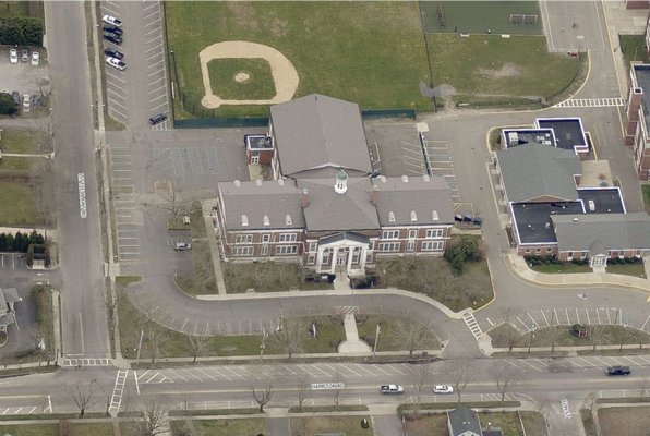
The town has attempted to remedy that problem for more than a decade by partnering with private companies to take aerial photography and imaging to see behind towering “Hamptons hedge lines,” Southampton’s geographic information system manager Ross Baldwin said. The first imaging flight was in 2006 by Pictometry International Corporation—funded by Suffolk County, as part of a countywide scan.
“Pictometry is the name of a patented aerial image capture process that produces imagery showing the fronts and sides of buildings and locations on the ground,” Mr. Baldwin said.
Pictometry International Corporation took to the skies again to update images for the town in 2008. Since June 2017, New York State allows Pictometry as a substitute for a field visit—that is, as long as the aerial images were taken during the last three years. Now, Ms. Goree said Southampton is on track to keep up with state requirements, starting with the new software licensing agreement with the company: Pictometry ChangeFinder will reduce the number of field visits necessary and allocate staff more efficiently by using a more advanced geographic information system, or GIS.
The software will “not replace initial physical inspections of properties,” and will be solely used for appraisals, she said. Pictometry ChangeFinder will now allow the office to capture previously undetectable taxable changes in a region, which Ms. Goree said could increase tax revenue by ensuring all property changes are recorded.
“ChangeFinder from EagleView uses automated software to compare historical high-resolution Pictometry imagery with current, up-to-date Pictometry imagery. Recent changes are then highlighted for rapid property assessment. These changes can include additions to a property such as pools, garages, sheds and home expansions, and can also detect demolitions. As a final step, a human quality check is completed on our end as well as by the assessors utilizing the product prior to making the final value determination,” said Robert Locke, EagleView senior vice president of government solutions.
Pictometry International and EagleView Technologies merged in 2013.
The Town Board approved spending $82,500 for the fly-over image collection and licensing agreement. The GIS Department also pays a maintenance fee to Pictometry for continued access to the images and software.


 JD Allen on May 25, 2018