


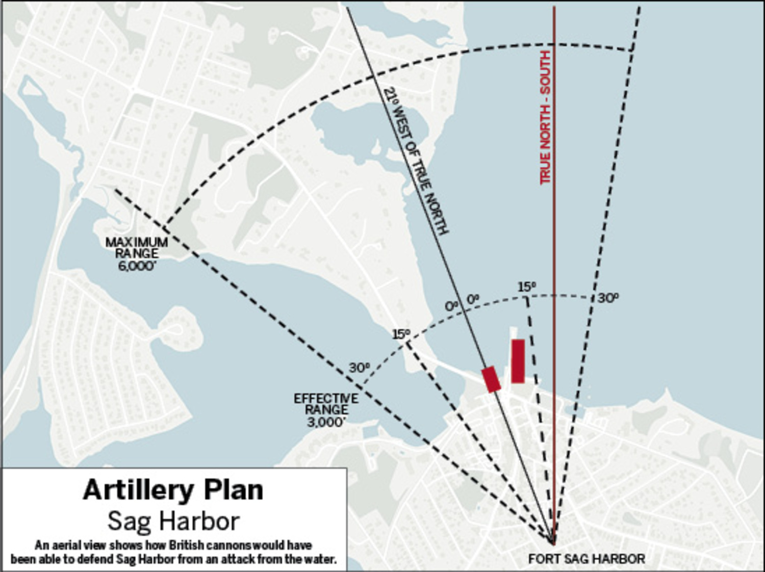
An aerial view shows how British cannons would have been able to defend Sag Harbor from an attack from the water.
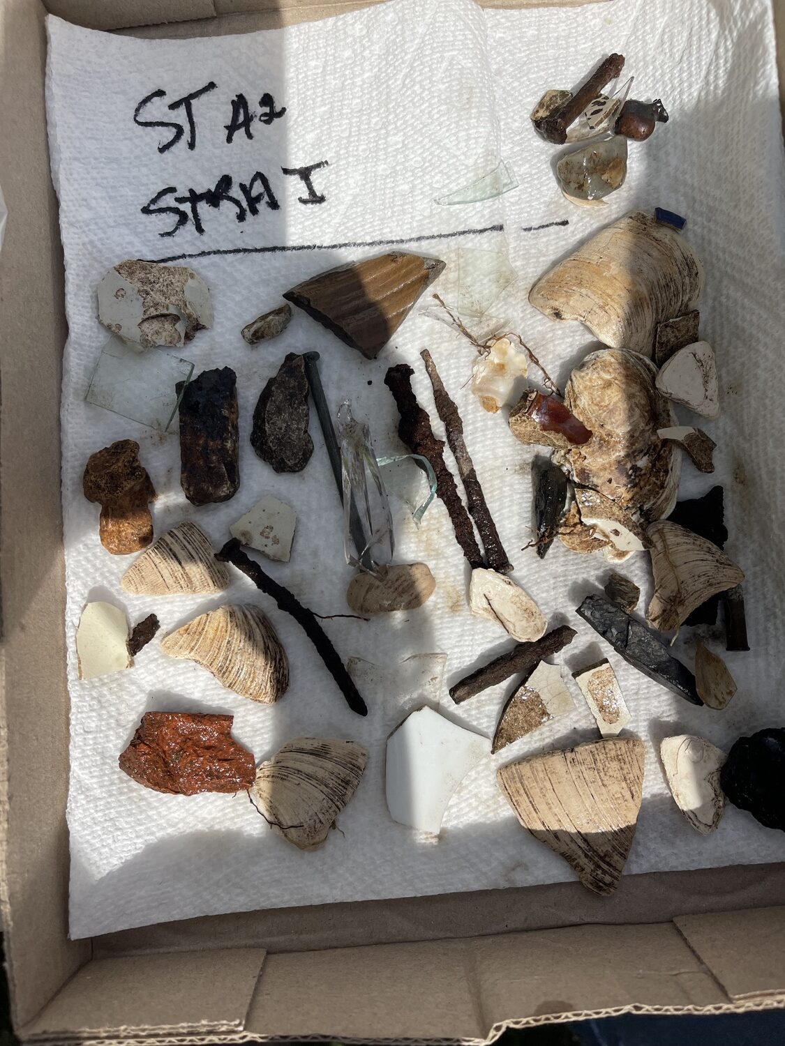
Some of the items uncovered during a recent archeological dig at the Annie Cooper Boyd House. COURTESY NANCY FRENCH ACHENBACH
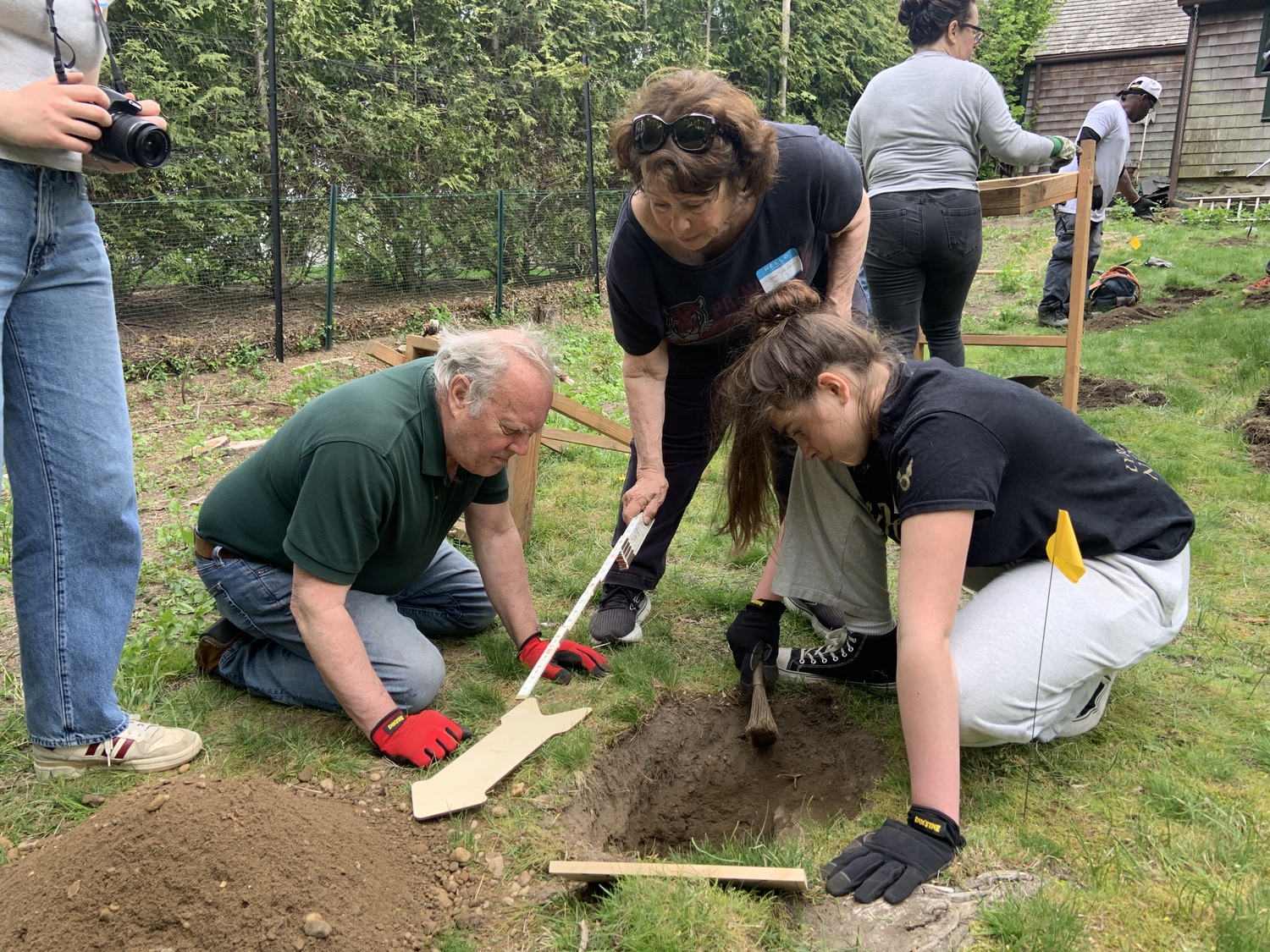
Zach Studenroth, Jo-Ann McLean, and Isla McLean take part in an archeological dig at the Annie Cooper Boyd House. FILE PHOTO
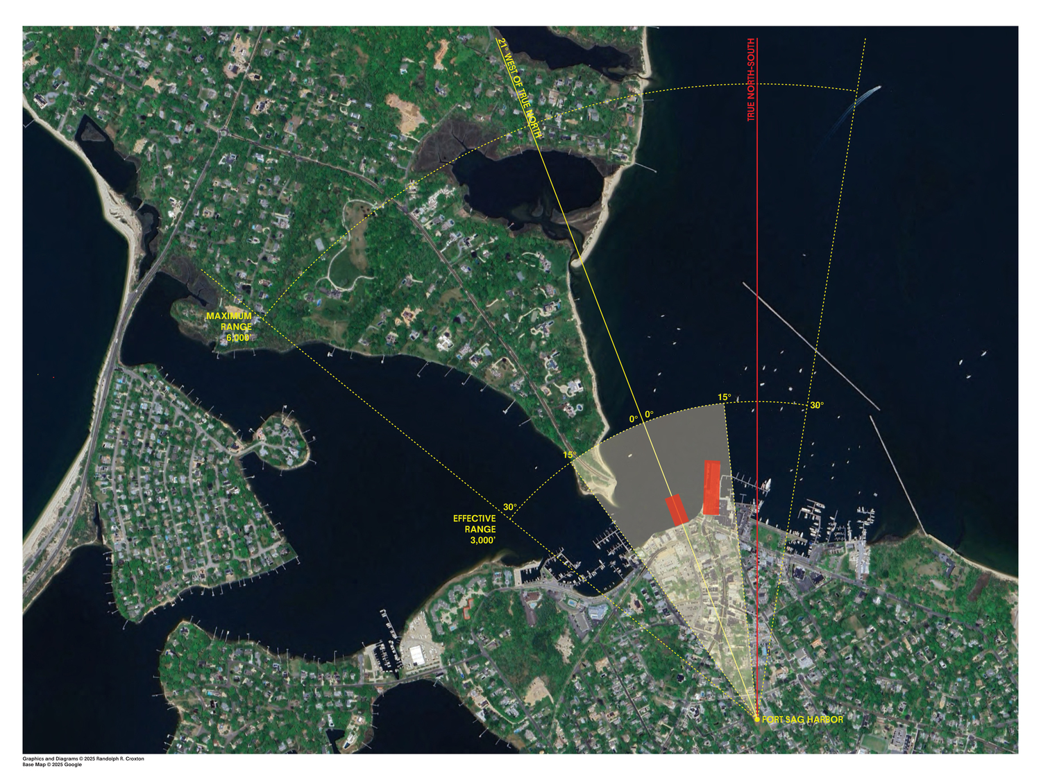
An aerial view shows how British cannons would have been able to defend Sag Harbor from an attack from the water. COURTESY RANDY CROXTON
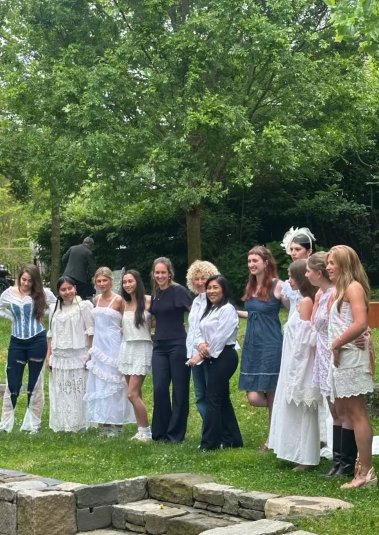
Pierson High School School students model clothing they designed based on an exhibit of historic clothing at the Sag Harbor Historical Museum last year. COURTESY SAG HARBOR HISTORICAL MUSEUM
Len Strozier of Omega Maping and Randy Croxton of the Sag Harbor Historical Museum worked with ground penetrating radar to help pinpoint the location of a British Revolutionary War fort next to the Old Whalers' Church. STEPHEN J. KOTZ
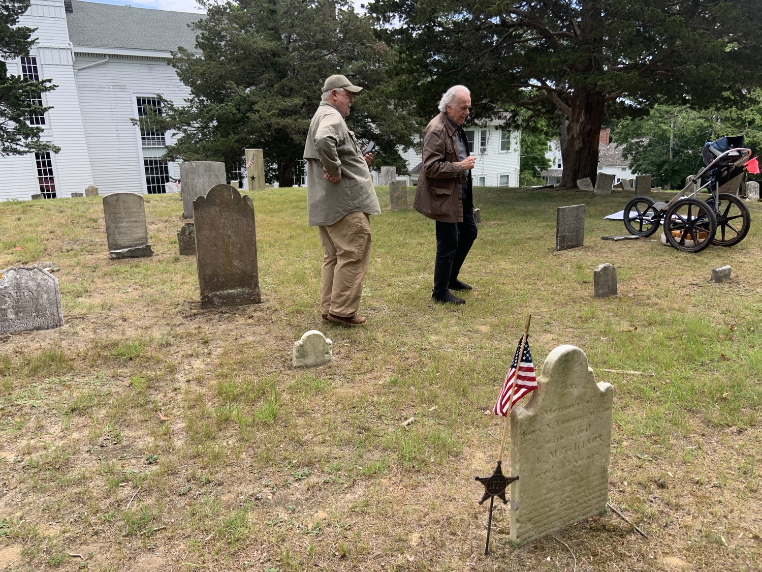
Len Strozier of Omega Maping and Randy Croxton of the Sag Harbor Historical Museum worked with ground penetrating radar to help pinpoint the location of a British Revolutionary War fort next to the Old Whalers' Church. STEPHEN J. KOTZ


 Stephen J. Kotz on Jul 2, 2025