


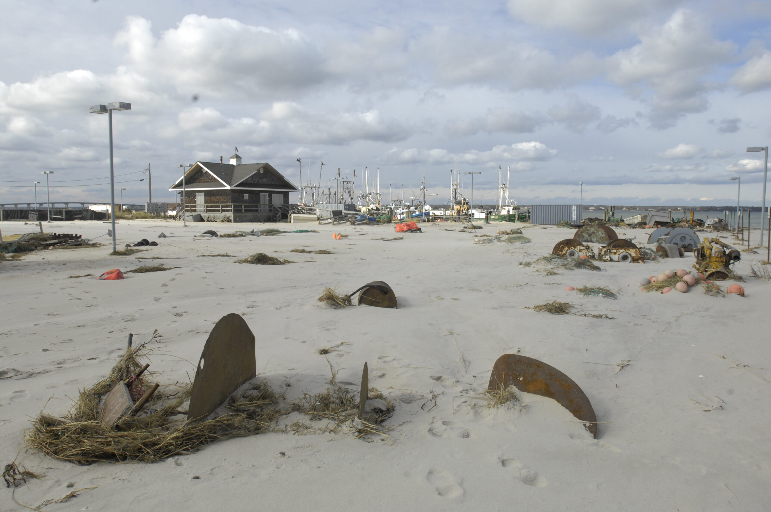
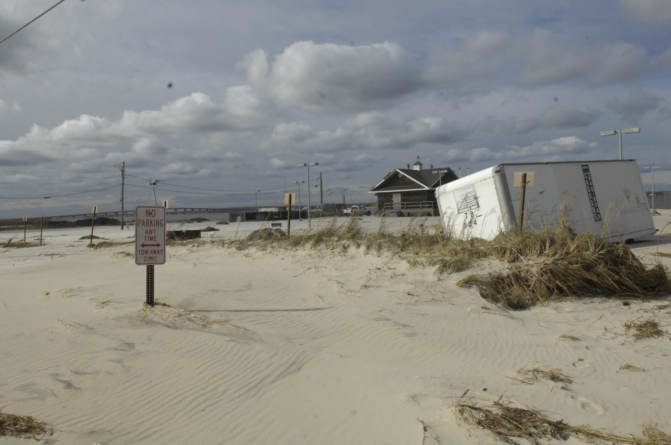
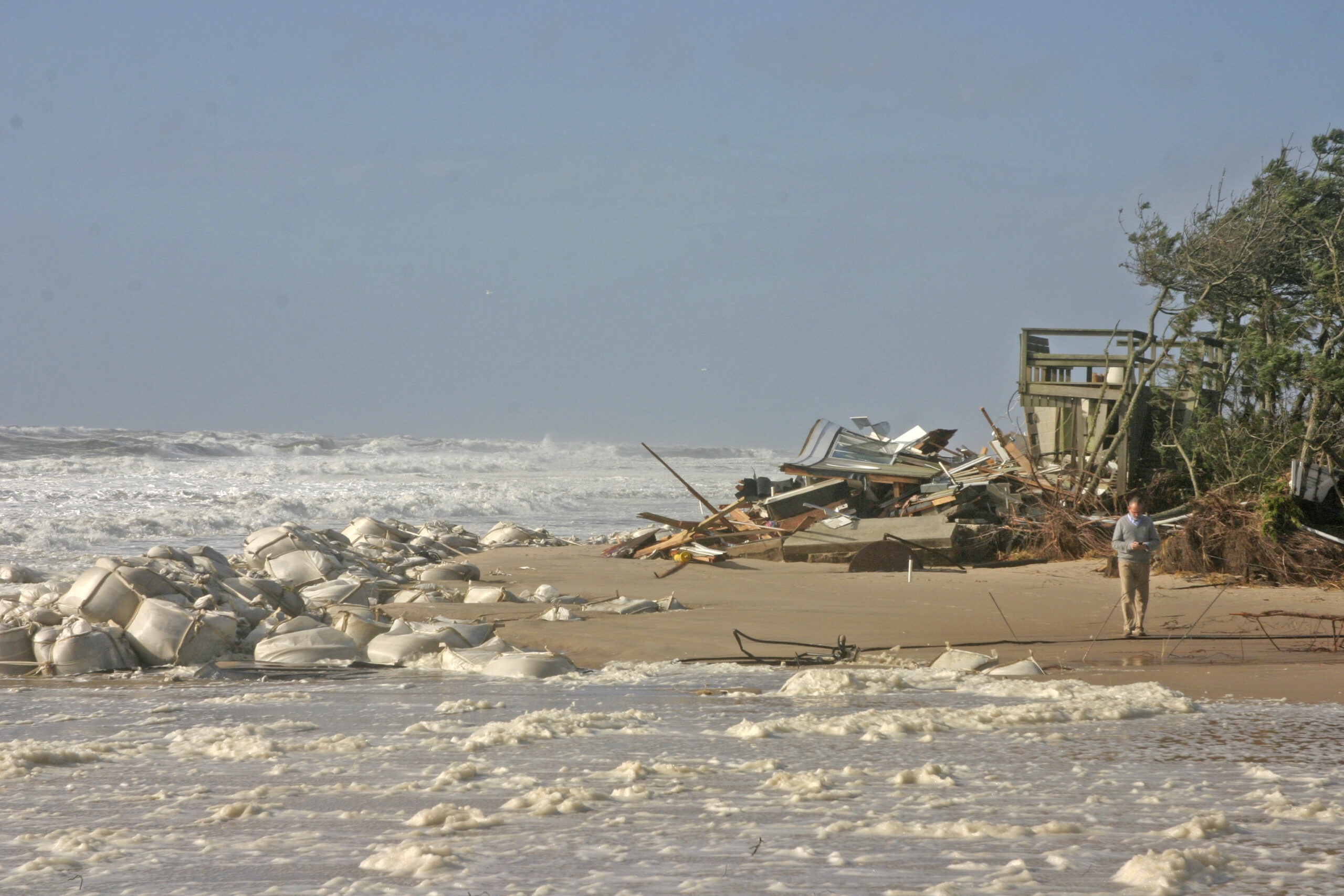
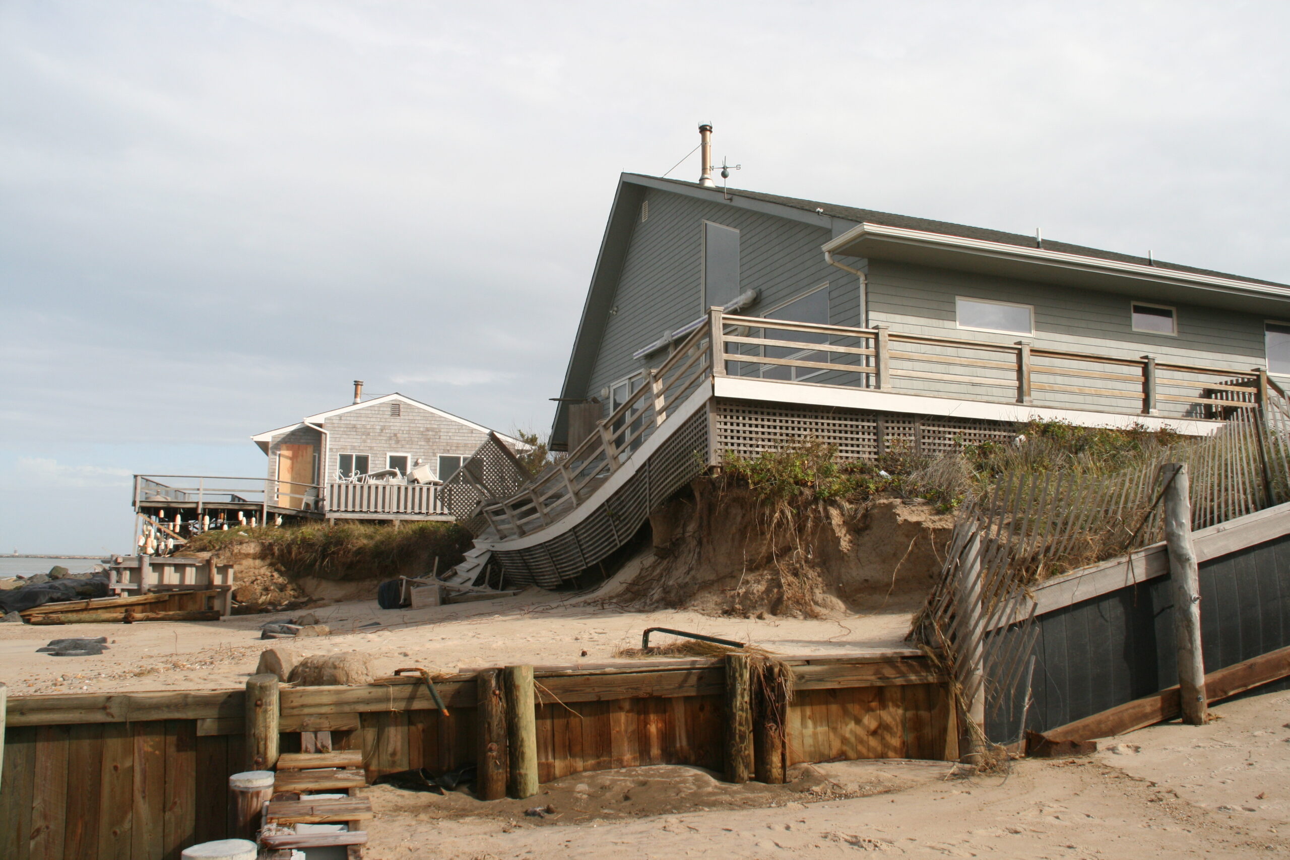
Damage at Mecox Beach after Sandy. DANA SHAW
Damage at Mecox Beach after Sandy. DANA SHAW
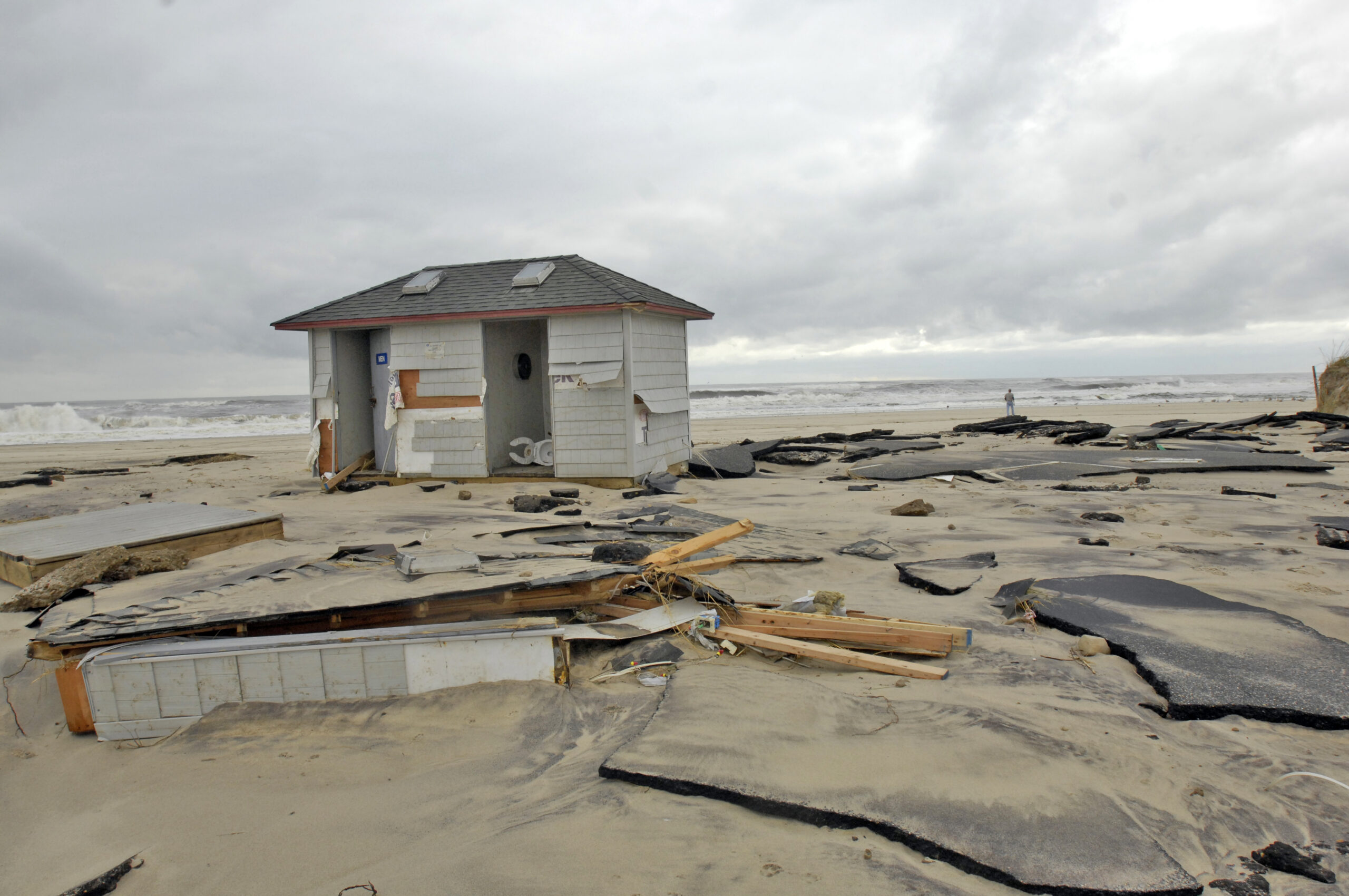
Damage at Mecox Beach after Sandy. DANA SHAW

Damage at Mecox Beach after Sandy. DANA SHAW
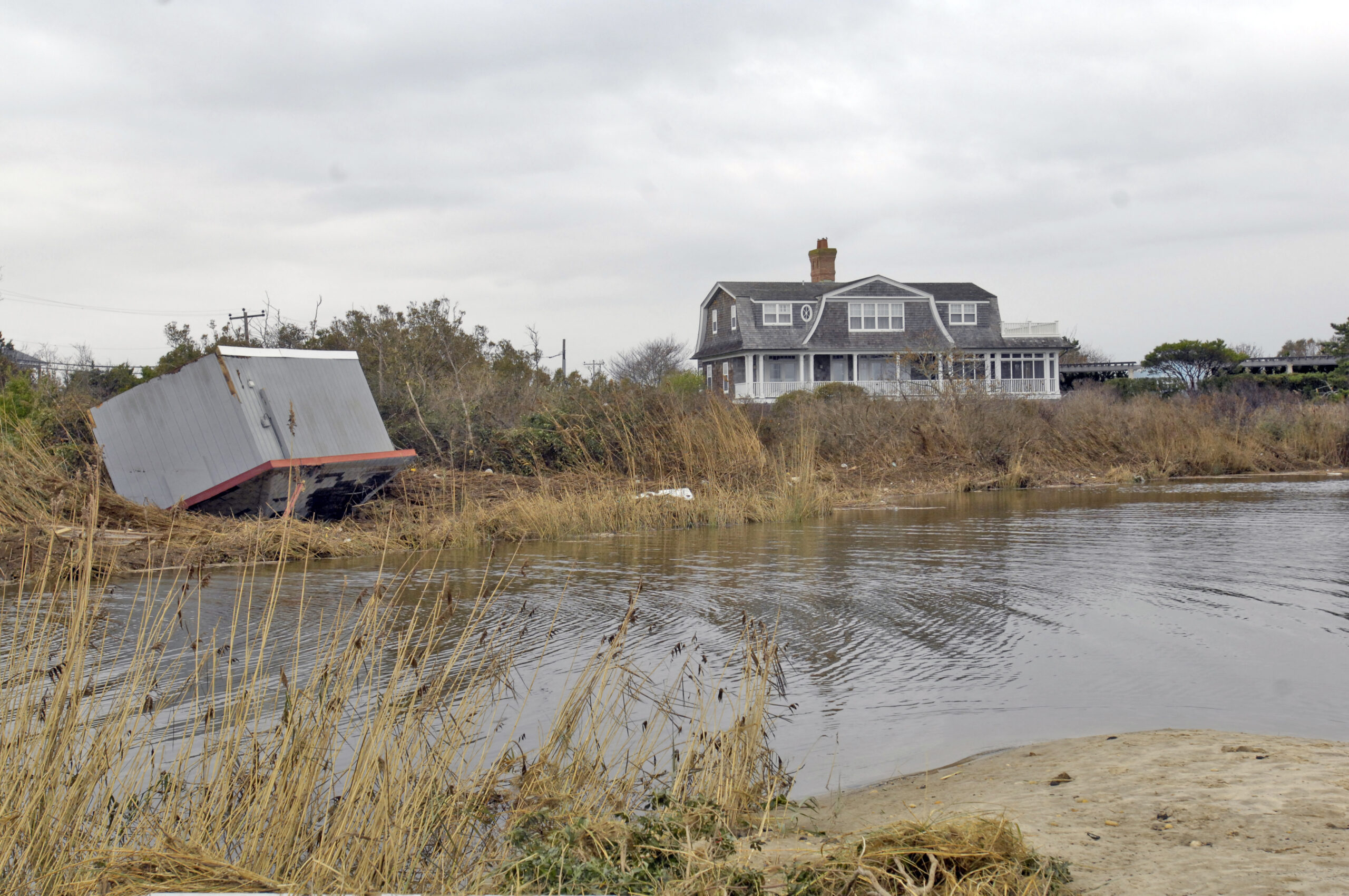
Dune Road in Hampton Bays after Sandy. DANA SHAW
Dune Road in Hampton Bays after Sandy. DANA SHAW
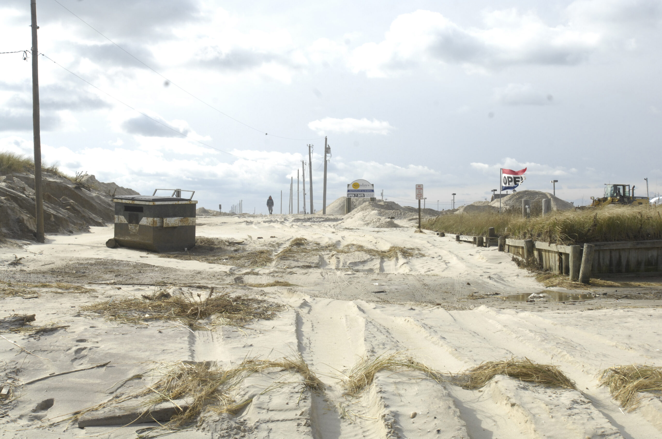
Dune Road in Hampton Bays after Sandy. DANA SHAW
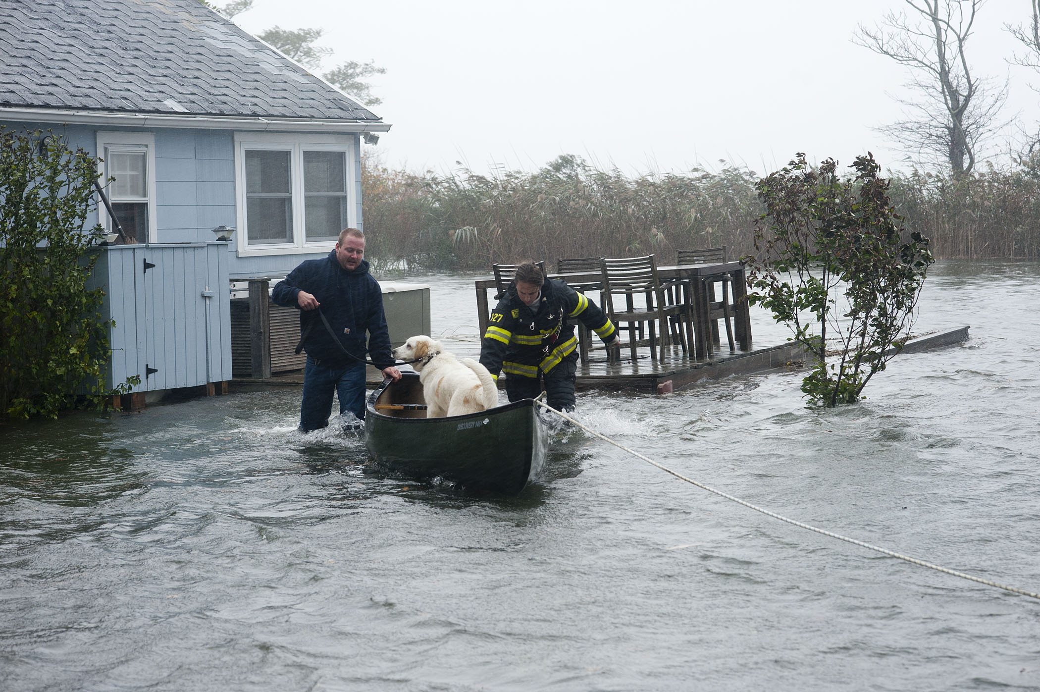
At roughly 11:00 a.m., Sag Harbor Firefighters Mike Labrozzi and Kelly Bailey use a canoe to transport a pet dog as they help rescue a Bay Avenue, Pine Neck resident and his pets who had become stranded due to rising water during hurricane Sandy on Monday, October 29, 2012. MICHAEL HELLER
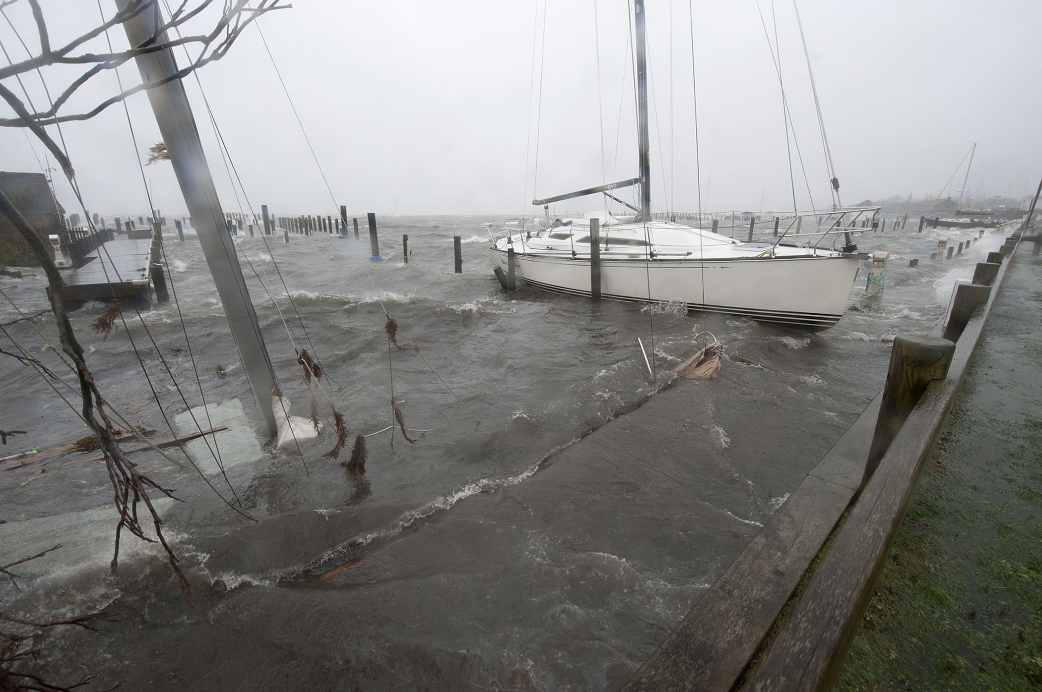
At roughly 4:00 p.m., a sailboat lay sunken at the west end of Marine Park during hurricane Sandy on Monday, October 29th, 2012. MICHAEL HELLER
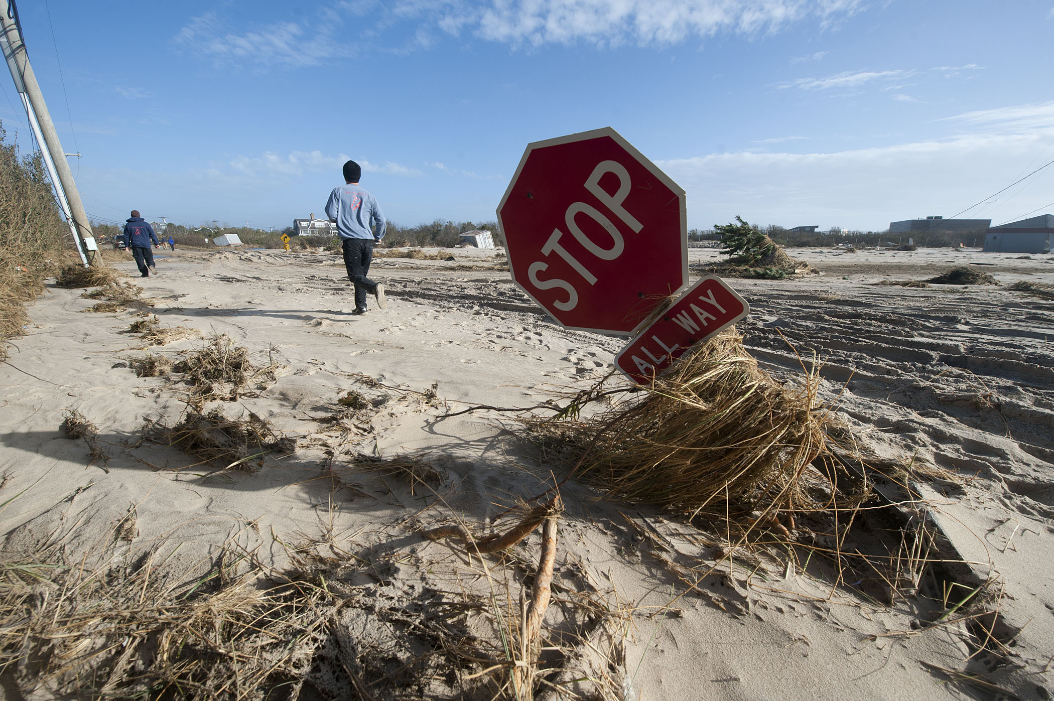
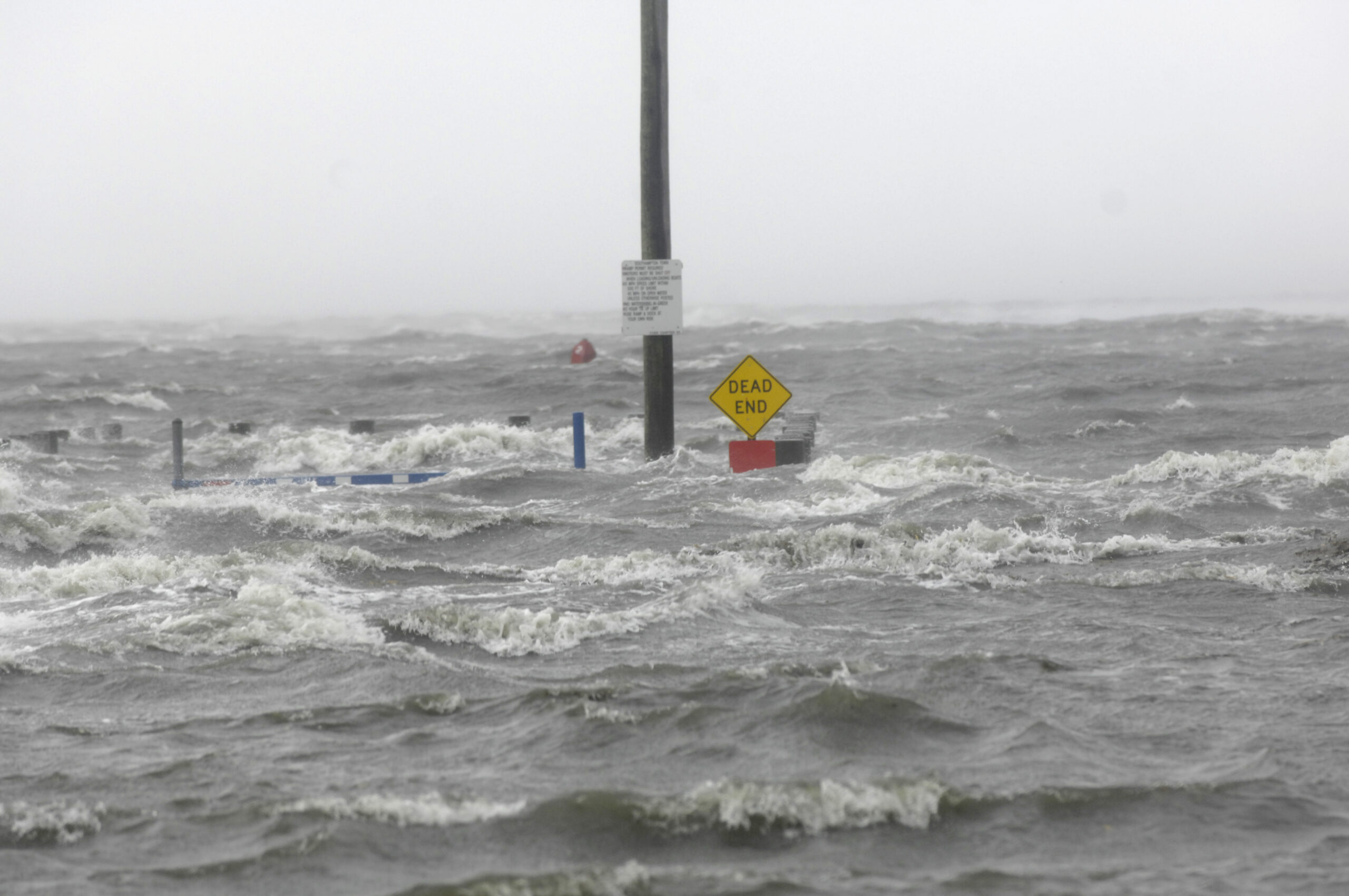
The intersection of Dune Road and Jobs Lane in Bridgehampton in the aftermath of hurricane Sandy on October 30, 2012. MICHAEL HELLER
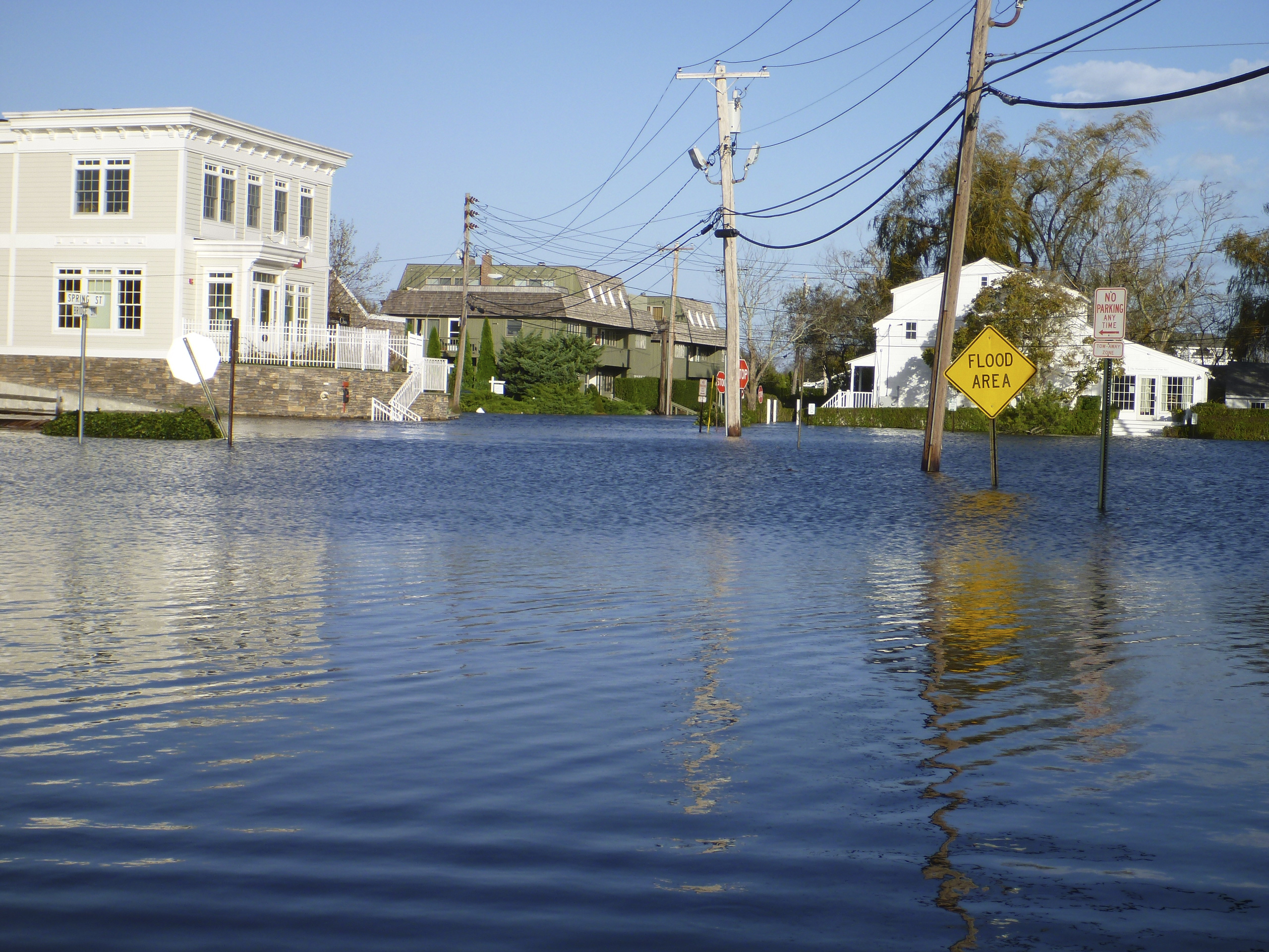
A view of the flooding in Sag Harbor from Spring Street the day after Sandy. JOE LOUCHHEIM
A view of the flooding in Sag Harbor from Spring Street the day after Sandy. JOE LOUCHHEIM
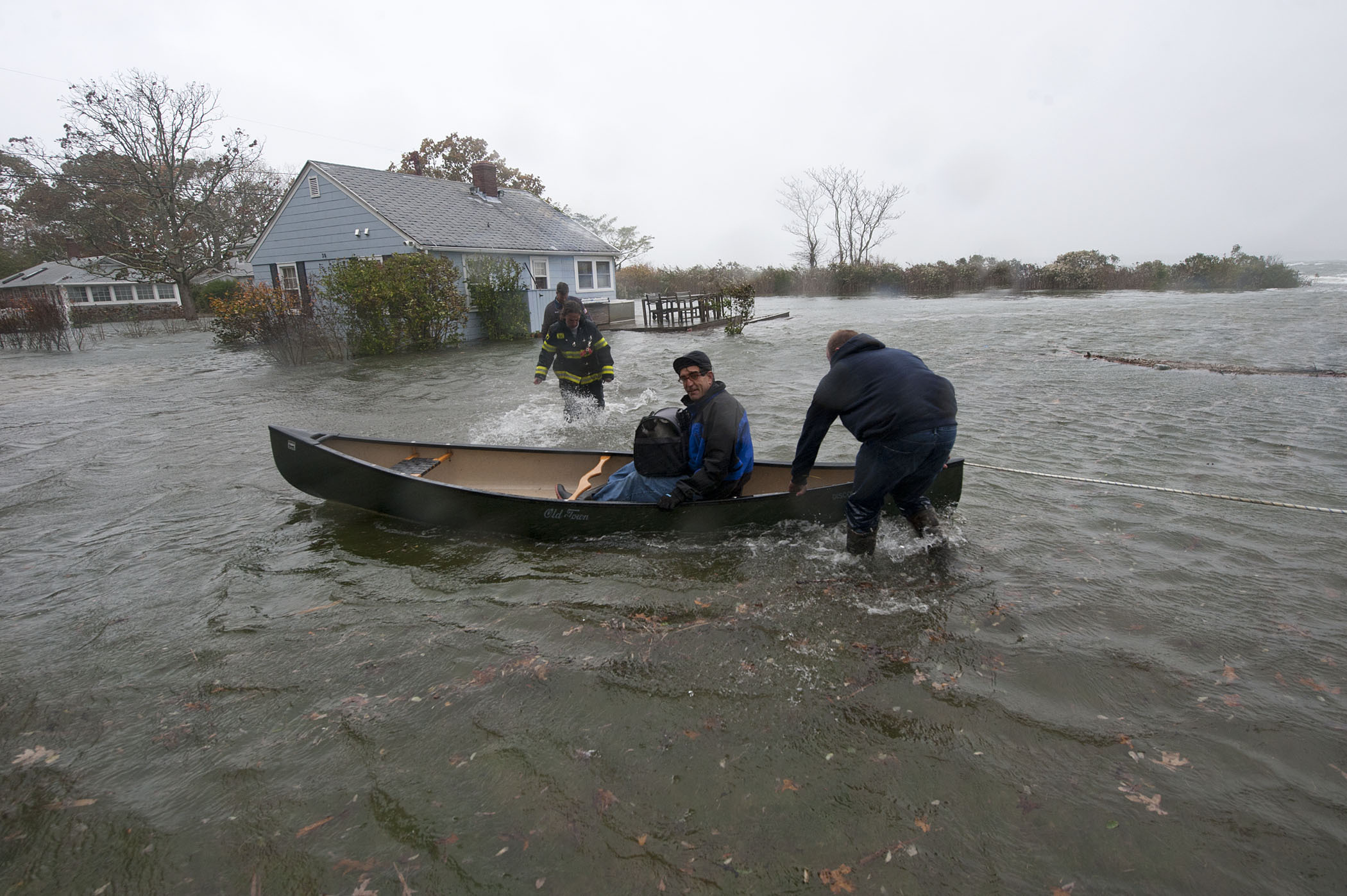
At roughly 11:00 a.m., Sag Harbor Firefighters Peter Topping, Mike Labrozzi and Kelly Bailey used a canoe to transport a Bay Avenue, Pine Neck resident and his pets who had become stranded due to rising water during hurricane Sandy on Monday, October 29, 2012. MICHAEL HELLER
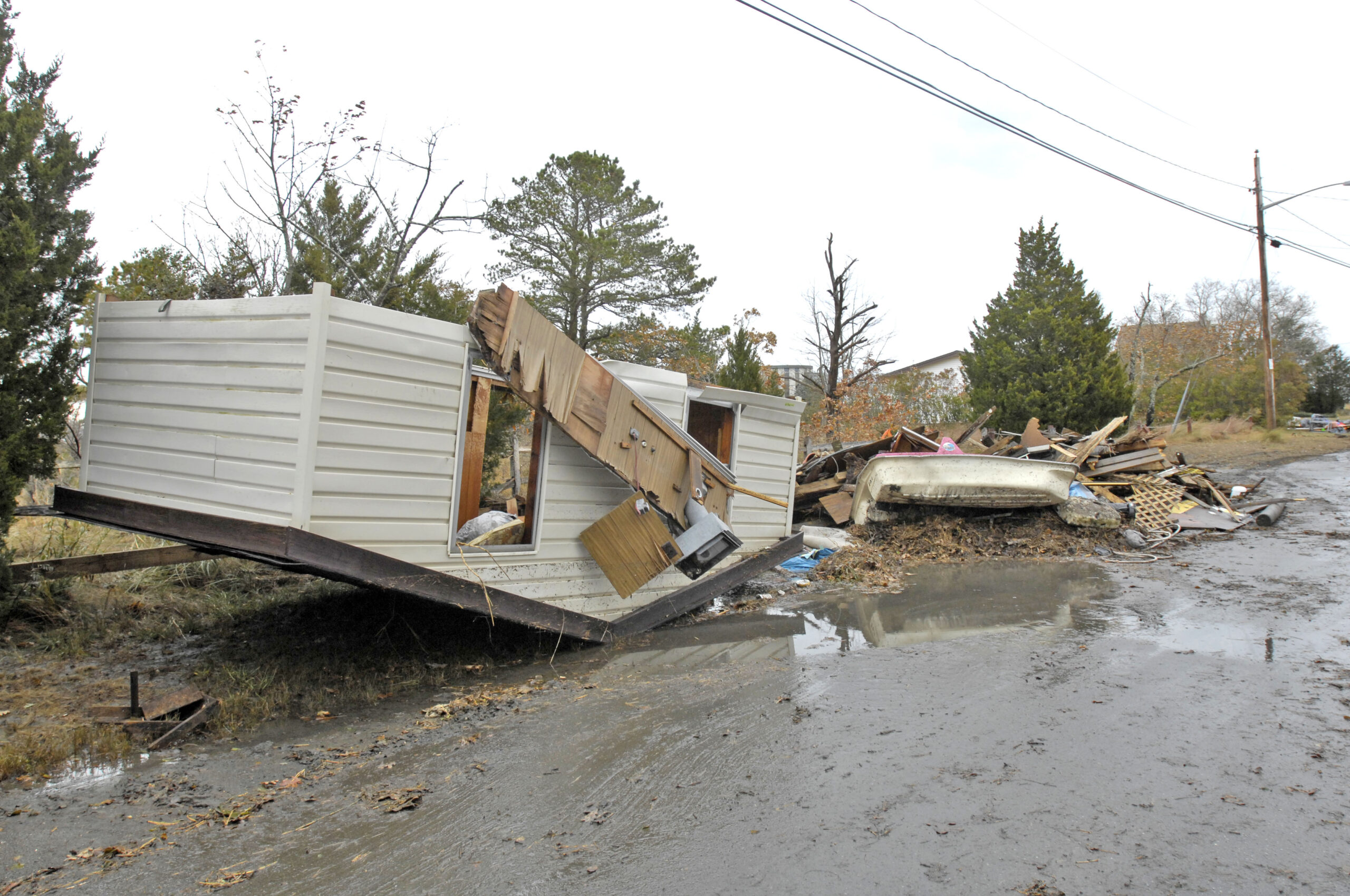
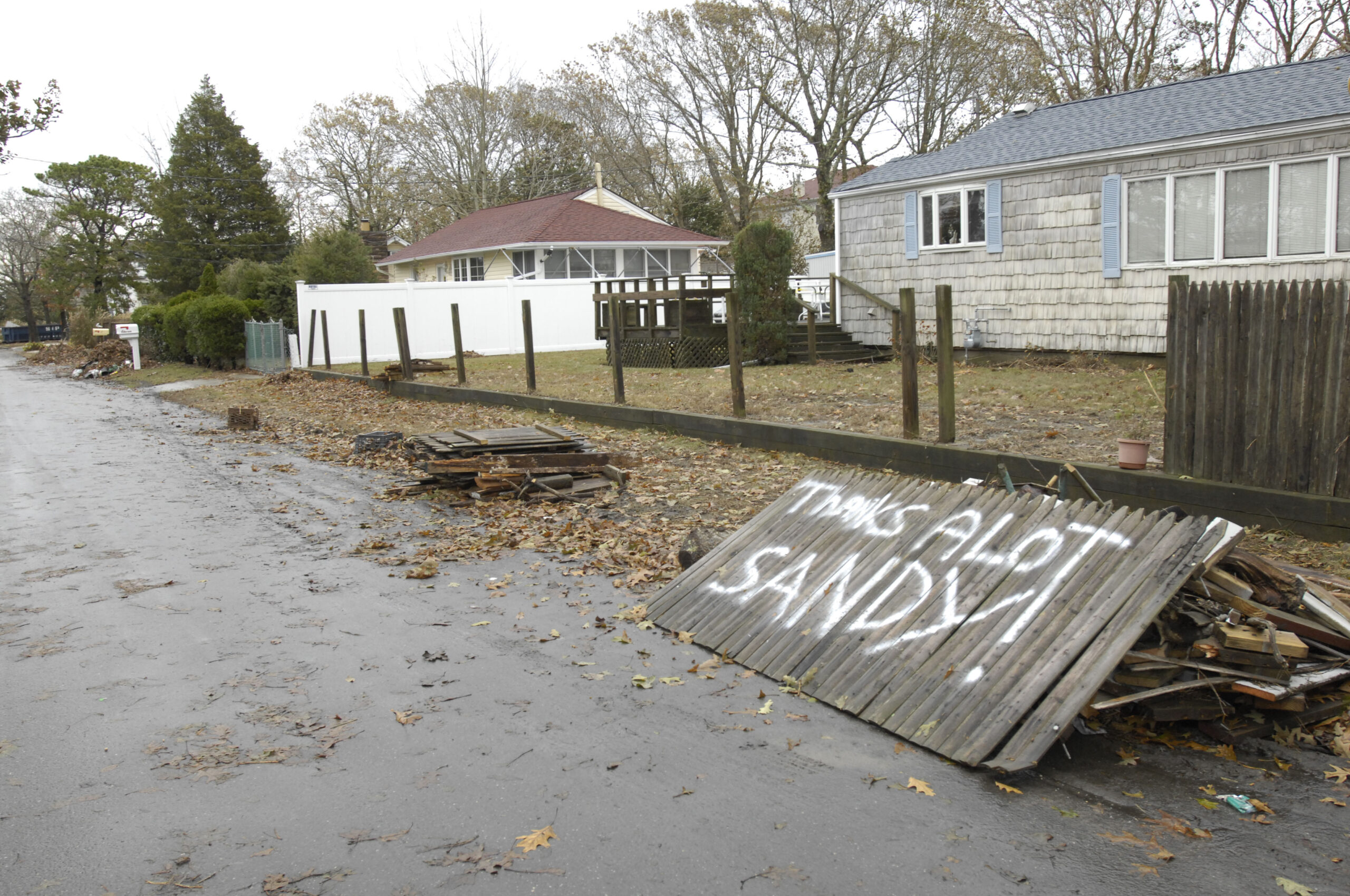
Damage from Sandy to homes on Pine Avenue in Flanders. DANA SHAW
Damage from Sandy to homes on Pine Avenue in Flanders. DANA SHAW
Damage from Sandy to homes on Pine Avenue in Flanders. DANA SHAW
Damage from Sandy to homes on Pine Avenue in Flanders. DANA SHAW
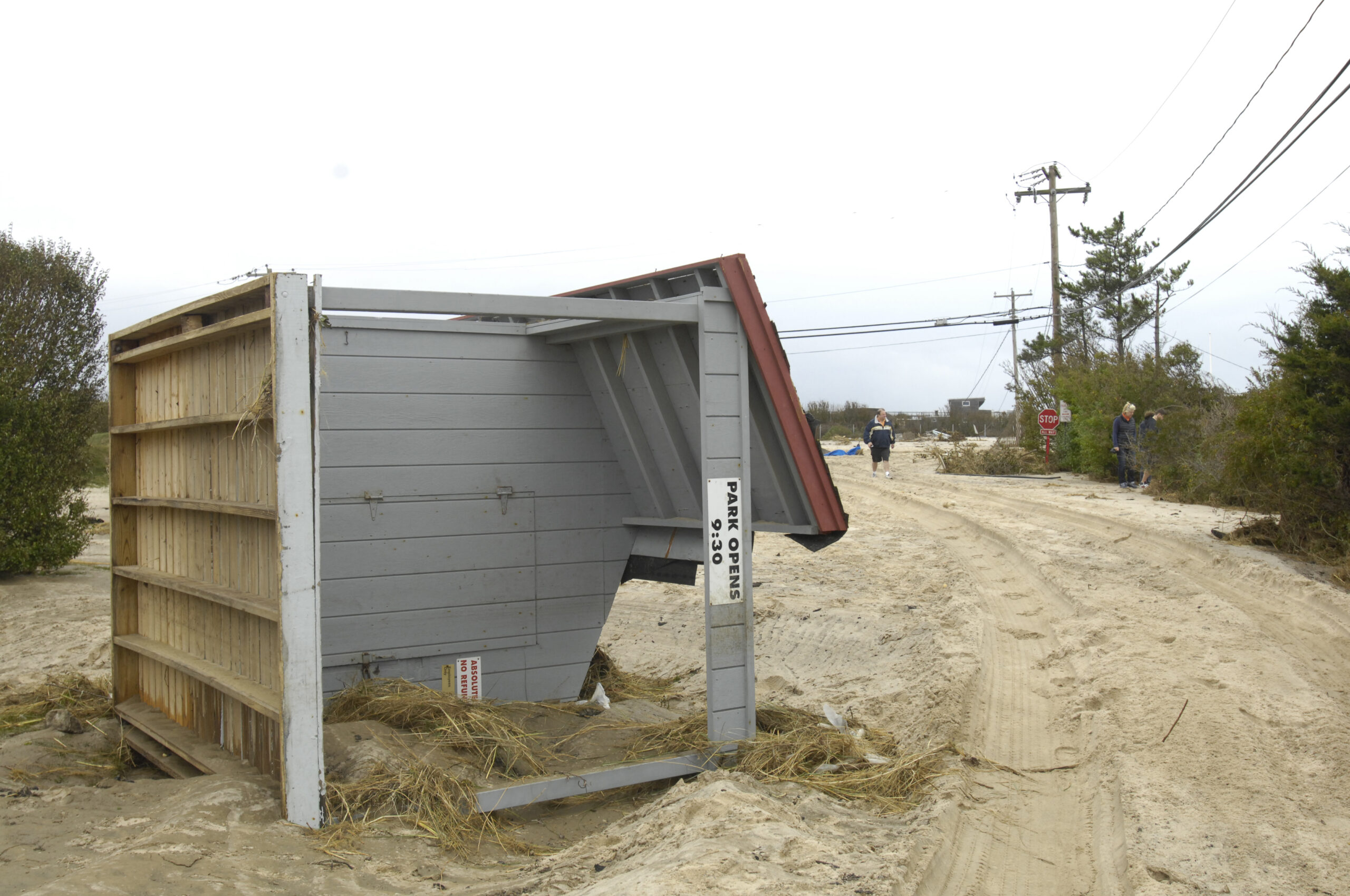
Marine Park in East Quogue is flooded during Sandy. DANA SHAW
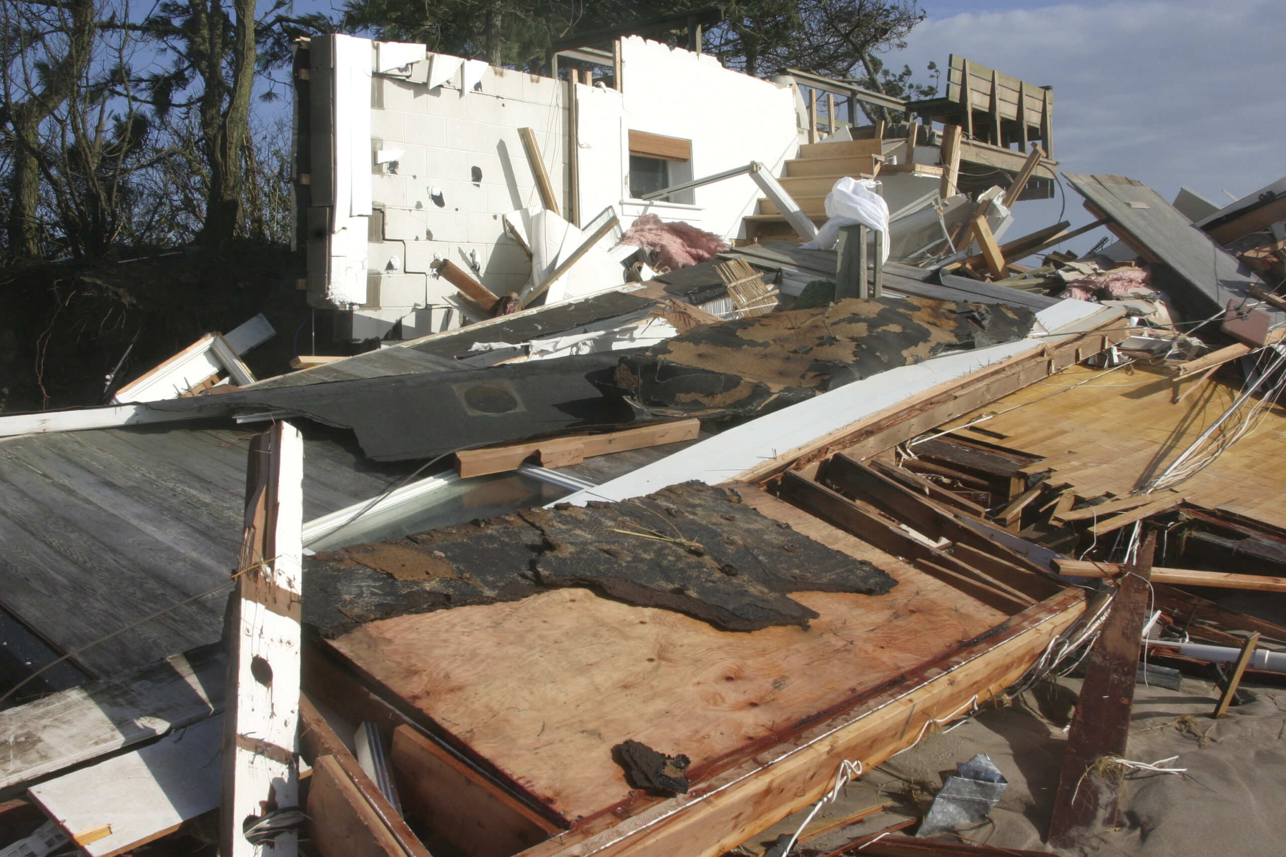
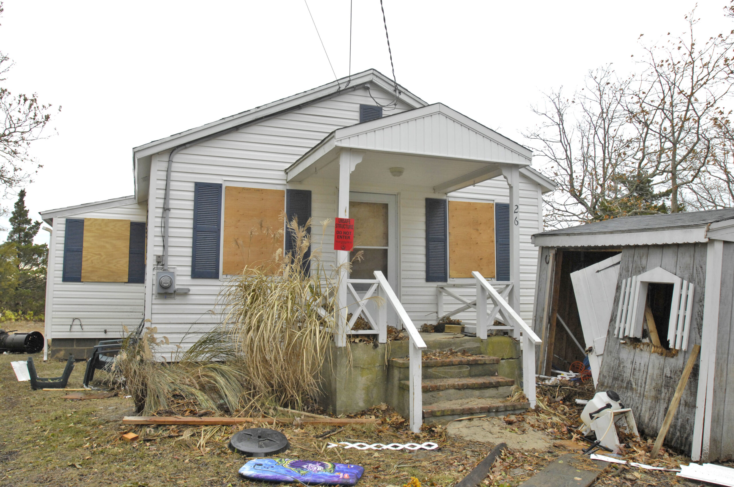
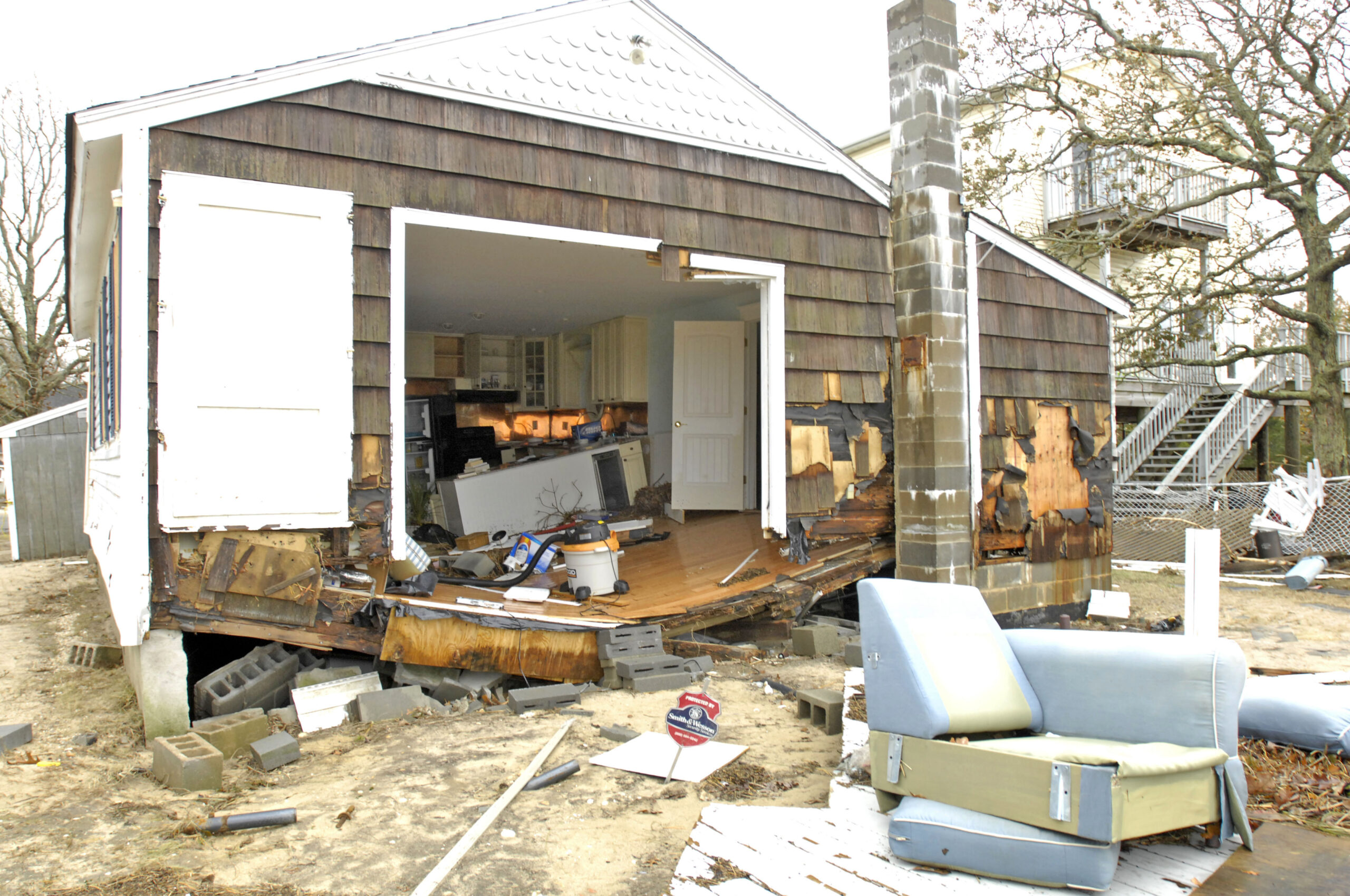
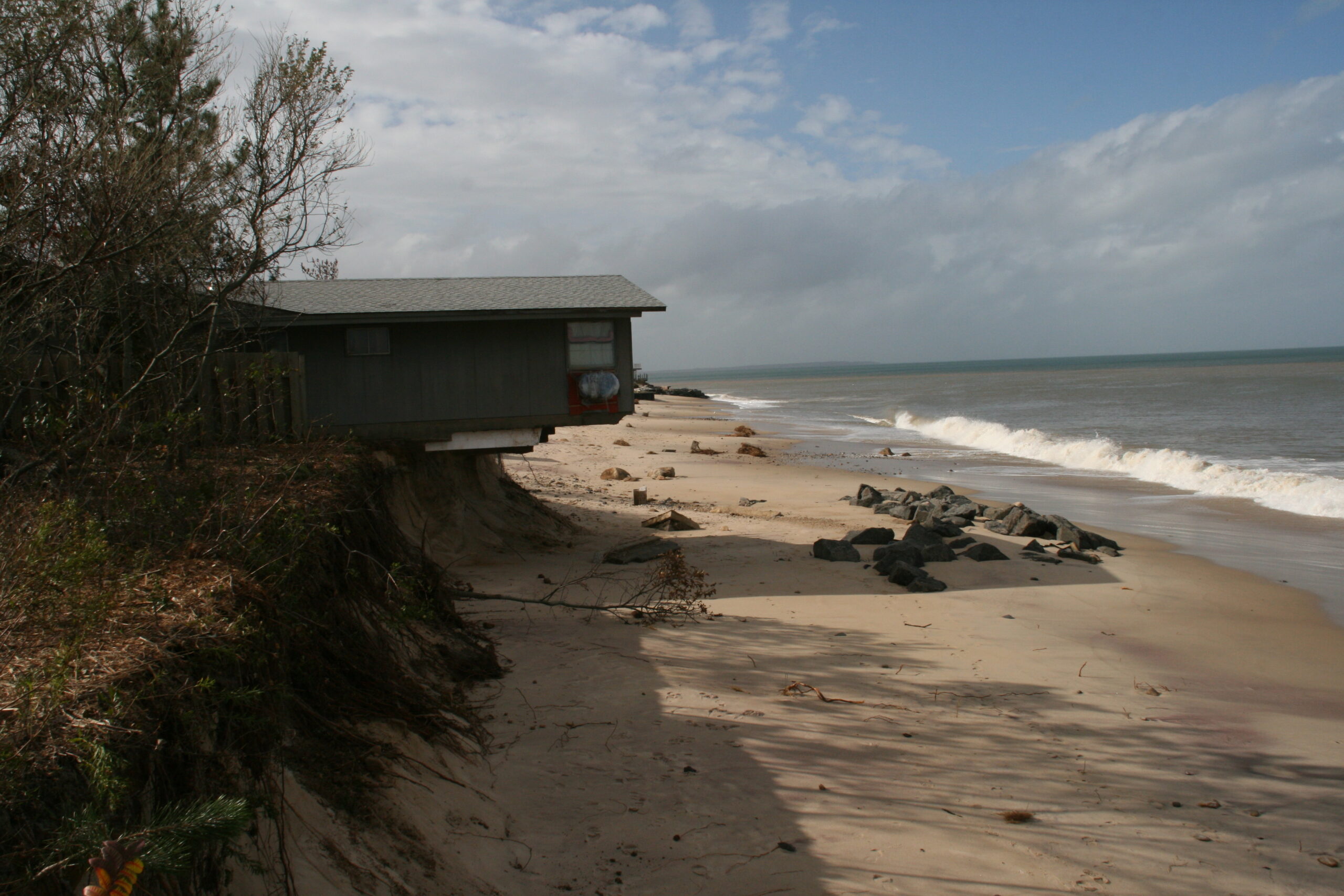
A house in Wainscott was destroyed by Sandy. MICHEL WRIGHT
A house in Wainscott was destroyed by Sandy. MICHEL WRIGHT
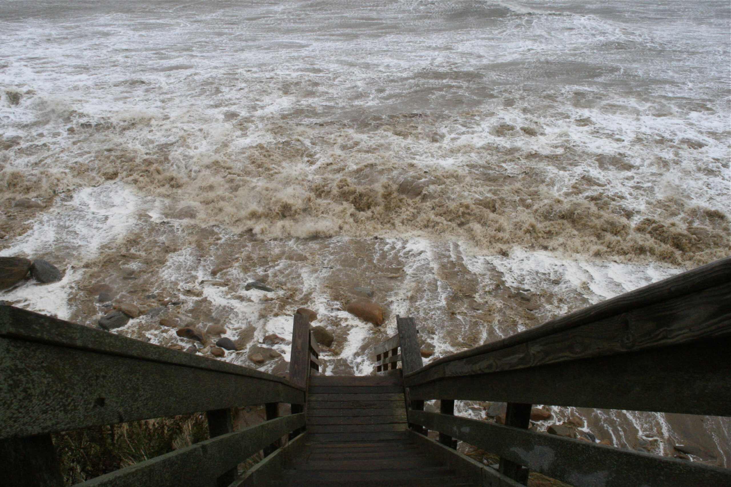
A view down into the roiling surf in Montauk during Sandy. KYRIL BROMLEY
Homes along Soundview Drive in Montauk take a beating during Sandy. KYRIL BRONLEY
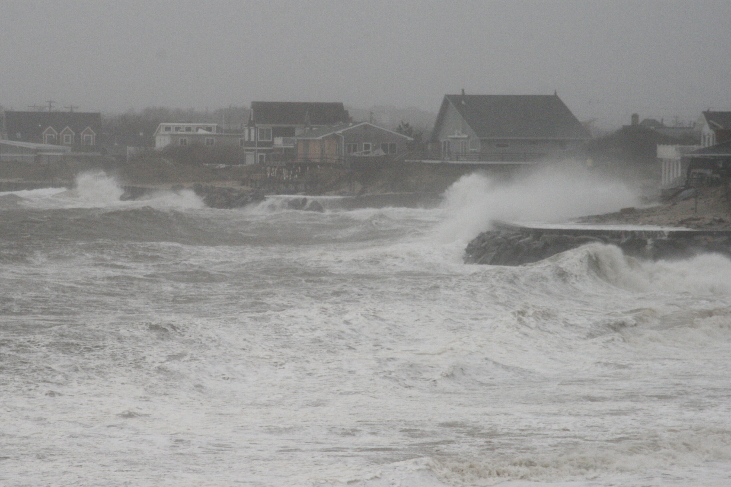
The roiling surf at the end of Town Line Road in Sagaponack as Sandy approaches. DANA SHAW

Bay Avenue in Noyac as Sandy approaches. DANA SHAW
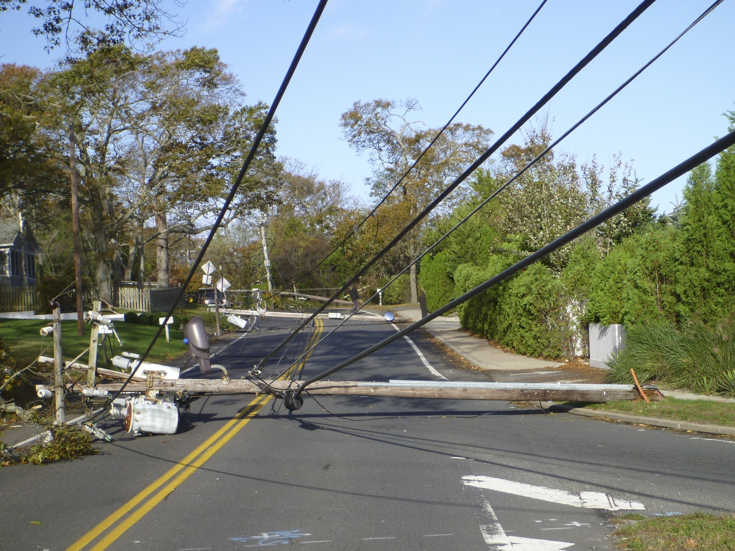
A light pole down in Noyac the day after Sandy. JOE LOUCHHEIM
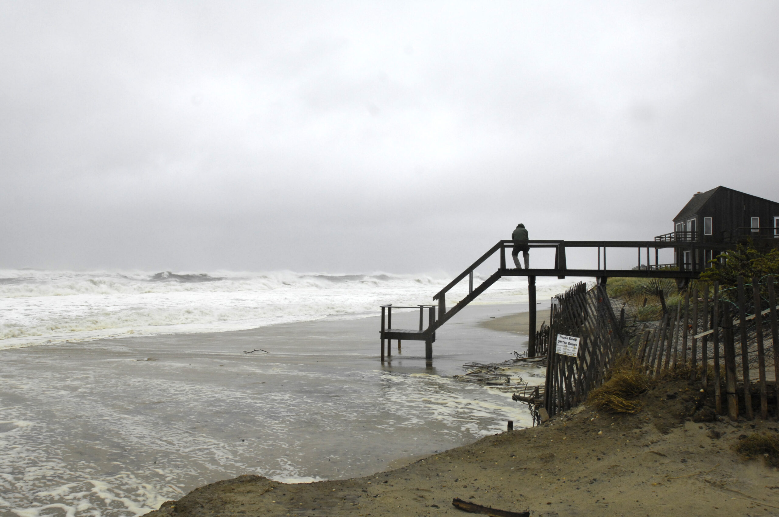
The beach under a house on Soundview Drive in Montauk eroded away. KYRIL BROMLEY
A damaged house on Soundview Drive in Montauk. KYRIL BROMLEY
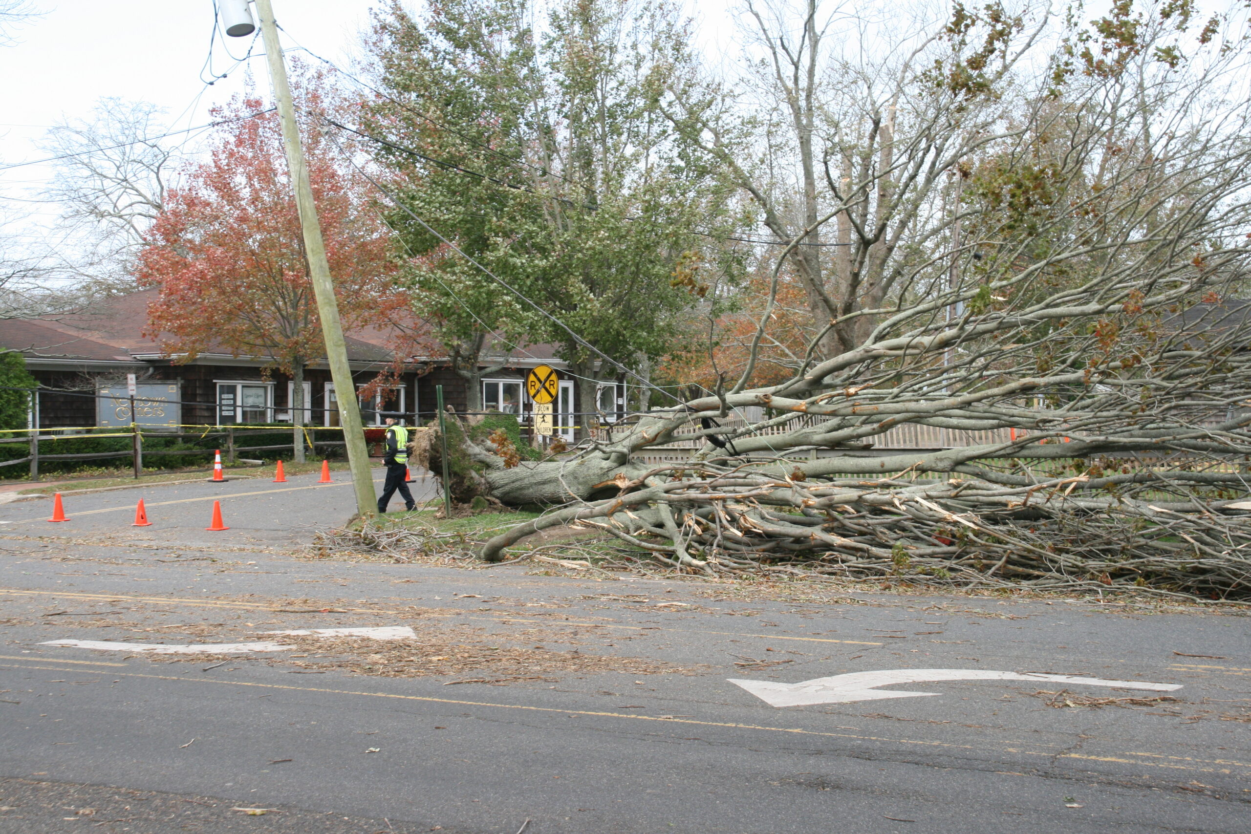
Newtown Lane in East Hampton Village the day after Sandy. KYRIL BROMLEY
Ten years ago this weekend, one of the largest and most unusual storms to ever form in the Atlantic Ocean, Superstorm Sandy, brushed the South Fork as it charged into the New York Bight, where it destroyed several communities and earned its place among the most destructive storms in U.S. history.
While spared the worst of the storm’s destruction, the South Fork still received an eye-opening wallop from storm surge and the fallout of decades of inattentiveness to the threats to electrical infrastructure and low-lying development far from the ocean.
The 5-foot-high surge of seawater pushed ashore by the passing cyclone obliterated ocean beaches in several areas, breached the barrier beach in East Quogue and Westhampton, and rendered entire neighborhoods along the shores of the Peconic Estuary uninhabitable, some for weeks — touching off a new storm, this one bureaucratic.
Falling tree limbs downed thousands of power lines and left some residents of the region without power for up to two weeks. A Montauk woman, Edith “Dee” Wright, died after being swept into the ocean by a wave while walking her dog — the lone local fatality related to the storm.
In its wake, Sandy was seen as a milestone, a turning point that was supposed to touch off sweeping reforms that would set the region on the path to being better prepared for such impacts, which are expected to become more frequent and more severe with global warming and sea level rise.
A decade later, some of that girding for future onslaughts has been achieved, but much of it is still in the offing — or on the shelf.
The Long Island Power Authority, for which Sandy brought about a reckoning, says that it has “hardened” the grid against storms and improved its ability to restore outages faster, with nearly $5 billion spent on upgrades to infrastructure and resiliency technology just since 2016.
Nonetheless, Tropical Storm Isaias left more than 500,000 Long Islanders without power for up to a week in 2020, though LIPA and PSEG Long Island, which took over running the Long Island grid two years after Sandy, say that storm, too, helped educate and improve their ability to restore power faster.
Along the oceanfront, Sandy spurred the dedication of $1.5 billion in federal money to finally fund the long-simmering Montauk to Fire Island Reformulation, or FIMP, that would steer the vast restoration of Long Island beaches rendered anemic by interruptions to the natural flow of sand along the shoreline by ill-designed inlets and protective groin fields. The effort is only just this year getting underway in earnest, and is at least a year off for the South Fork — and still mired in bureaucracy.
Bayside homeowners whose homes were inundated by the storm spent years tangled in red tape as they tried to tap some of the $61 billion in federal aid that was supposed to help them rebuild in ways that would leave their neighborhoods better protected for “the next time.” Many, if not most, sold their homes before or soon after, uninterested in even the thought of having to go through such a bureaucratic grinder again.
Suffolk County convened a task force to examine the response to Sandy and make recommendations for improvements to how a broad variety of municipal services would react — and could react — the next time a major storm struck. The committee issued its report in 2019, noting that some of the most needed improvements to things like communications have been made already, while others, like solving the gargantuan debris removal problem that beset places like Long Beach in the wake of Sandy, are still in need of much planning.
But those who participated in the process say that some key hitches, particularly in terms of communication between support agencies, have been broadly addressed since Sandy, and that with the critical priorities spotlighted, it will be easier for the remaining needs to be addressed in time.
“No two storms are alike and you can’t prepare for everything, but what you can do is have the right relationships in place, and the communication there,” said John Bouvier, a Southampton Town councilman who sat on the Suffolk County Superstorm Sandy Review Task Force. “This does inform us on what we should do. There are a lot of players: the county, the state, PSEG, FEMA. The reaction has been pretty good — a lot of the recommendations the report made are already in place.”
As the name by which the storm is remembered might indicate, Superstorm Sandy was not a typical hurricane.
First of all, it formed very late in the year, and especially so for a hurricane to make landfall in the Northeast. Having formed as a traditional hurricane on October 21 in the Caribbean, where it battered Cuba and other island nations as a strong Category 3 storm, it moved up the coast over several days, losing and regaining strength right up until the morning of its landfall in New Jersey, when it reached Category 2 strength.
As it approached the coast, the hurricane was drawn into a second storm front coming off the East Coast and became “extratropical” — meaning it no longer relied on warm waters beneath it for its strength — just hours before making landfall in New Jersey. It still packed hurricane force winds and pushed a storm surge as much as 14 feet high into the bight, where Long Island and New Jersey pinch New York City.
Physically, Sandy was enormous, with tropical storm strength winds spread out over a more than an 1,100-mile area — the largest ever recorded in terms of its physical breadth.
The estimated $67 billion in damage it did, mostly in the Northeast, made it the sixth most costly storm in U.S. history.
Congress approved $61 billion in recovery aid and “resiliency” funding to improve the region’s preparation for absorbing or fending off the impacts of future storms.
The most high-profile impact on the East End was the impact of the storm surge along the coastline, which erased already badly eroded dunes in Wainscott, Sagaponack, Bridgehampton, Hampton Bays, East Quogue and Quogue, flowing beneath the foundations of oceanfront mansions and breaching the barrier island at Cupsogue County Park and nearly breaching in East Quogue.
After Sandy, in Sagaponack and Bridgehampton, homeowners and Southampton Town banded together and self-funded a $25 million restoration of the beaches along a six-mile stretch between Flying Point and Townline Road. The project pumped 2.5 million cubic yards of sand, dredged from the seafloor nearby, and created a 100-foot-wide beach and restored the natural slope of the subsurface seafloor, to dampen the impact of storm waves as they come ashore and allow protective dunes to rebuild naturally.
As that project nears the end of its 10-year anticipated life — having dodged another hit from a major storm surge — the homeowners are preparing to fund another nourishment in 2023 or 2024.
They expect to be able to piggyback on the first major beach nourishment on the South Fork funded under the FIMP plan, which is due to get underway in January 2024 — though that schedule is still contingent on some bureaucratic hurdles that are proving inordinately time-consuming to clear. The federally contracted dredges, whenever they arrive, will rebuild beaches in East Quogue, Hampton Bays and Montauk.
“The most dire area is Tiana,” said Aram Terchunian, a coastal engineering consultant from Westhampton Beach who shepherded the Sagaponack-Bridgehampton nourishment project and has represented both Southampton and East Hampton towns in their planning for FIMP with federal and state officials. “From that area to the middle of Quogue, the beach is low and narrow, and the dunes get eroded more or less every year.”
He added, “They’ve been very lucky not to get another Sandy.”
The broadest impact of the storm, of course, came well away from the shorelines, where even homes that barely had a branch down were left without power for several days — some for nearly two weeks. Officially, it took 17 days for all power to be restored on Long Island.
The year before Sandy struck, Tropical Storm Irene had come ashore on Long Island and left many without power for up to 11 days, and the second hit spurred major changes. Management of the Long Island electrical grid was handed over to PSEG, a New Jersey-based utility company.
Together, LIPA and the newly formed PSEG Long Island embarked on a campaign to make Long Island’s grid better able to withstand storms with fewer outages and to make it easier to restore power to customers faster when widespread outages do occur.
Since Sandy, LIPA has tripled its investments in infrastructure, spending some $4.9 billion since 2016 — including $730 million on “storm hardening” the grid. Utility poles have been made more stalwart and lofted above trees where possible — a step sometimes met with aesthetic objections, and even lawsuits, from East End residents. The wires themselves have been made thicker. Power substations, including the one in Montauk, have been raised above anticipated flood water levels.
And LIPA has steeply increased its tree trimming budget. During Sandy, the islandwide grid suffered 37,000 individual incidents of damage to its transmission network from the storm, mostly from falling tree branches. With decades between severe storms, trees often grow up and around power lines and even a medium-sized branch breaking off can bring down a line.
“The largest driver of outages is vegetation related: falling limbs, falling trees, blowing debris contacting conductors,” said Billy Raley, LIPA’s senior vice president in charge of transmission and distribution. “We’ve made significant changes to our vegetation management. We’ve increased the budget by more than 40 percent … removing vines, trimming trees, taking down trees that are diseased or in close proximity to lines. We removed 5,000 trees last year.”
Raley said that once-common objections to the sometimes ghastly trimming of centuries-old trees to clear their branches from around power lines once drew cries of objections from residents. After the outages caused by Irene, Sandy and Isaias, “we’re getting almost zero complaints,” Raley said.
Technological improvements, like computer network management that can show where damaged distribution lines are and facilitate rerouting power supply to skirt the damage and restore electricity to areas where equipment is still intact, are speeding recovery times.
“We have a long way to go there, and we are, quite frankly, a little bit behind,” said Raley, who came to LIPA 18 months ago from utilities in the South, where power companies have stepped up technological improvements faster than Long Island has. “But we are quickly catching up.”
Raley said that LIPA and PSEG are now well ahead of the national average for restoration times and that LIPA officials are confident that the region’s grid is far better prepared for a major storm than they were even a couple years ago.
While the storm surge hammered oceanfront mansions on the South Fork, few suffered serious damage, and none were primary residences, which meant owners were not left homeless.
But in low-lying neighborhoods in Shinnecock Hills and Flanders, the story was quite different.
As the winds from the storm shifted to the northeast as the storm swept past, a new surge of water flowed into the bays with a rising tide, inundating several neighborhoods with flood waters that lingered for weeks. Dozens of homes were left permanently uninhabitable.
The federal aid package funded New York Rising, a massive state-managed effort that was supposed to help homeowners whose properties were damaged to rebuild and raise homes above flood levels to protect them in the future.
But the enormous effort struggled to find its logistical legs and suffered from difficulties in coordinating with insurance companies, preventing fraud, and avoiding long delays in providing the expected funding. And many homeowners simply didn’t have the financial means or wherewithal to embark on rebuilding projects, even with the promise of eventually being made whole.
Frank and Gail Zappone said that they were among the lucky ones, both because their home on Middle Pond in Shinnecock Hills flooded, but the waters receded, and some quick ripping out of saturated carpeting and drywall staved off mold damage — but also because they had the savvy to navigate the cumbersome bureaucracy. As a bureaucrat himself, Frank Zappone, the deputy supervisor for Southampton Town, worked with other residents whose homes had been flooded while he worked to restore his own home and saw firsthand the difficulties that force many to sell and move elsewhere.
“In the beginning, the support infrastructure was confusing, inefficient and difficult to communicate with, and the rules kept changing,” Zappone recalled. “You had to lay out the money to get money back. That was well beyond the means of a lot of homeowners.
“And they didn’t offer any services, you had to find the contractors and do all the work and manage it all yourself. There were 17 properties that people just walked away from because they couldn’t manage that transaction.
“Eventually they got it right,” Zappone added of the state-managed program, which eventually made no-interest loans available to those needing major repairs or reconstruction that could then be paid off with aid funding when work was completed and costs accounted for. “But it took three years.”
In the end, Zappone’s own house, which had about 2 feet of water in it during the storm, was rebuilt and lofted 11 feet higher.
Since Sandy, the region has crept toward being better able to fend off another storm like Sandy or, eventually, one much worse, but has only been spared from the lingering weaknesses being exploited by meteorological luck.
East Hampton Town has arguably taken the greatest strides toward addressing the long term threat of major storms, with the adoption of its Coastal Assessement and Resiliency Plan earlier this year. Over three years, the plan examined all of the town’s low-lying areas, from downtown Montauk to Lazy Point, and assessed what steps could be taken to protect them in the future. In many cases, as with the hotels along Montauk’s oceanfront and some especially vulnerable areas on the bayside, the plan recommends that the smartest course of action in the long term would be to remove the development from the water’s edge.
Last year, Hurricane Henri, which had been forecast to make landfall on the South Fork as a Category 1 storm, with winds up to 100 mph — 62 mph was the highest gust clocked on the South Fork during Sandy — took a sudden jog to the east over Block Island.
Hurricane Gloria in 1985 remains the last hurricane to make landfall on Long Island, and Bob, in 1991, was the last to bring actual hurricane force winds to the island. Rarely had the region gone 20 years without a direct hit before that.
Bouvier said that he feels that while response has been slow in the offing, much has been learned since Sandy and that smart planning has set in motion the sort of improved preparations that will someday have the area well prepared to weather hurricanes — even if it isn’t “the next time.”
Improvements to the grid — including the establishment of “micro-grids” that would be able to supply power to critical locations even if broader outages hit the region — and staging for recovery and assistance, even what to do with downed tree limbs, are in the works.
“Given the unpredictable nature of storms, we’ll always have to be reactive — from the local first responders to the federal government — but our communication is going to be much better now, we have already set up a very good network now, which is a big part of making sure that people are protected,” Bouvier said. “I feel like we’re on the right track.”


 Michael Wright on Oct 26, 2022