


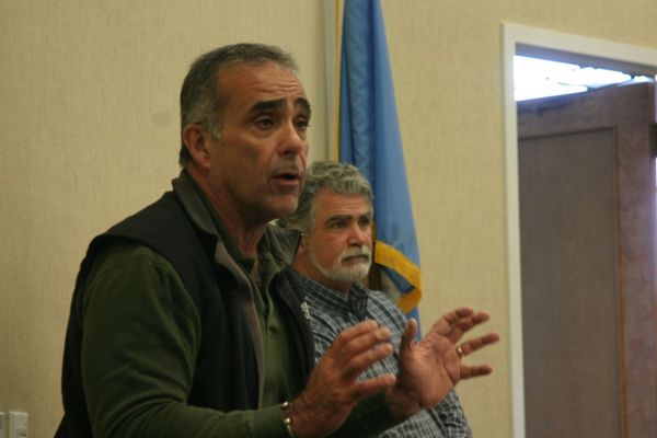
West Hampton Dunes Village Mayor Gary Vegliante told Sagaponack residents that areas that had been the focus of beach renourishement projects in recent years fared better in the storm than areas that hadn't. MICHAEL WRIGHT
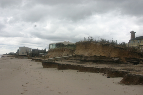
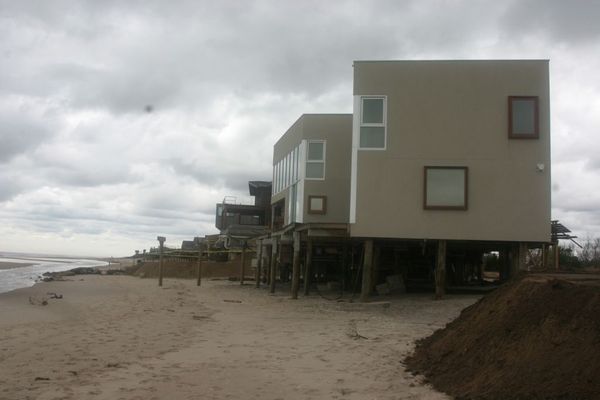
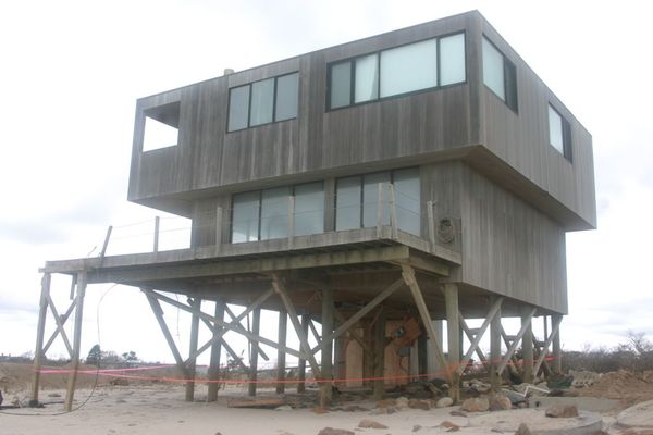
Erosion along the Sagaponack oceanfront. MICHAEL WRIGHT
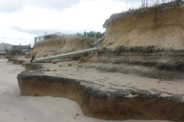
Erosion along the Sagaponack oceanfront. MICHAEL WRIGHT
Erosion along the Sagaponack oceanfront. MICHAEL WRIGHT

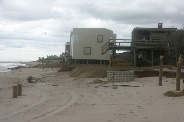
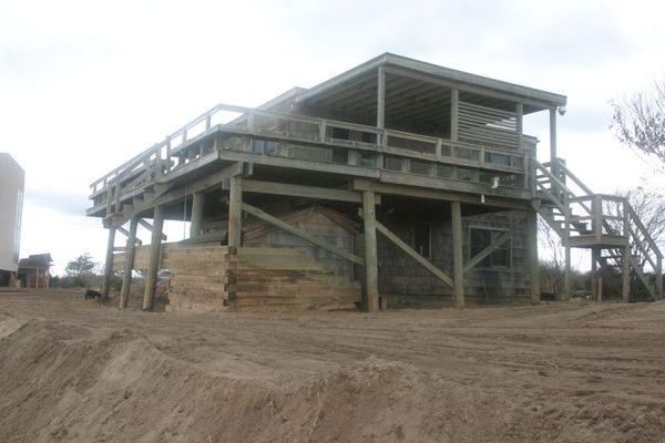
Damage to houses off Daniels Lane in Sagaponack. MICHAEL WRIGHT
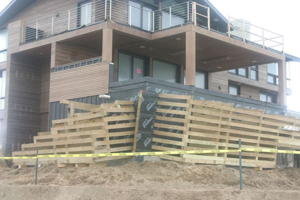
Residents fear that a nor'easter forecast for this weekend could cause further damage to homes. MICHAEL WRIGHT
Southampton Town is lifting permit application requirements for depositing sand for rebuilding beaches and dunes. MICHAEL WRIGHT
Some houses had the dunes and sand around their foundations completely washed away during Hurricane Sandy
leaving them vulnerable to future storms. MICHAEL WRIGHT
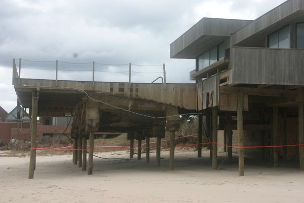
Some homes sustained structural damage that will have to be repaired before the foundations can be covered with sand again. MICHAEL WRIGHT

Residents are bei


Southampton Town officials say they will revive the push for approval of a massive beach nourishment project in Water Mill, Bridgehampton and Sagaponack to help restore beaches and dunes decimated by Hurricane Sandy this week.
The project still will be difficult to get done during the coming winter, however, and, in the meantime the town is encouraging oceanfront homeowners both east and west of the Shinnecock Inlet to dump tons of sand and erect walls of large sandbags in front of their homes to protect them from the ocean in the coming months.
Because of the emergency nature of the needed protection, with a nor’easter predicted to possibly hit the area midweek, the town and Town Trustees have waived all their normal approval requirements and approved the placement of sand with simple notifications to town officials, and will allow sandbagging—including the use of the giant, interwoven sandbags known as Geocubes—as long as the work is coordinated with town environmental officials. All fees and vehicle permit requirements have been waived as well.
“The immediate priority is for most homes, especially those that were undermined by the storm, to construct an emergency sand berm, and that it be done now so there is not additional damage,” Southampton Town Chief Environmental Analyst Marty Shea told a crowd of several dozen homeowners and consultants at Town Hall on Saturday morning. “Put the sand as high up from the surf line as possible, as close to your house as possible. We can work on redesigning the dune later.”
The town and state emergency permits do not allow the placement of rocks, steel cofferdams or Geotubes as protective measures. Mr. Shea said the Geocubes, which are linked together, are the preferred protection, because they deflect the energy of waves but allow water and sand to flow through them, so they do not cause erosion at their edges like hard structures.
With the foundations of dozens of houses in Sagaponack, Bridgehampton and Quogue entirely exposed and dangerously weakened by Sandy’s pounding waves, many homeowners there are looking toward the decimated beachhead and the ocean beyond, now hundreds of feet closer to their homes than it was just a week ago, with concern about the coming winter storm season.
The National Weather Service said on Friday that it is looking at the possibility of a major coastal storm forming by the middle of next week and that it could impact the tri-state region and Eastern Long Island.
Most of the damage to homes seen during the storm came in the stretch of oceanfront between Water Mill and Wainscott. In some stretches, hundreds of feet of beach and dune were washed away by Sandy, and dozens of houses had their foundations exposed and decks and outer walls ripped off. One structure, the clubhouse of the Water Mill Beach Club, was almost entirely destroyed.
Much of that area—six miles of beach stretching from Flying Point to the East Hampton Town line—is slated to receive more than two million tons of sand if a proposed $24 million beach nourishment project is approved by the town. The project had been on pace for an approval this month but was stalled by the objections of two property owners—a farming family from Sagaponack and a private beach club in Bridgehampton—to having to pay the six-figure costs of the project over the next 10 years, since they have donated conservation easements over their properties. Legislation at the state level that would allow the properties to be exempted was due to be reviewed in January, which would have meant the project could not go forward until next fall.
But on Saturday homeowners pressed town officials to pick up the ball and push the project forward on an expedited basis, and to push at federal levels to lift restrictions that would prevent it from happening this winter.
“It seems irresponsible to put this off for another year and put at risk miles of beachfront,” one resident said. “Is there a way we can deal with the Whites and the beach club that would allow this to go forward now?”
The White family, one of Sagaponack’s oldest farming families, have a development easement over all of their 24-acre oceanfront farmland—they sold the development rights to the town for $14 million in 2007 through the Community Preservation Fund—but would have to pay more than $60,000 a year toward the special property tax put in place to pay for the renourishment project. The Bridgehampton Club would have to pay a similar sum for their 12-acre oceanfront parcel, on which they donated the development rights to the Peconic Land Trust in the 1990s.
State Assemblyman Fred W. Thiele Jr. said that he would explore options by which the legislation exempting the two property owners could be expedited at the state level but encouraged the town to move forward with the project immediately regardless. “There could be some emergency thing we can do, but the question is whether two property owners are going to dictate what happens to the entire beach,” he said. “Whether they’re going to pay or not pay, it seems that action is required.”
West Hampton Dunes Village Mayor Gary Vegliante recalled that in the early 1990s a similar proposal to rebuild beaches there was derailed by the objections of two property owners, and a series of winter storms shortly afterward caused massive erosion and a breach in the beach that led to the destruction of more than 100 homes.
Chronic erosion in the stretch of beach west of the three stone groins near Georgica Pond in East Hampton Town has intermittently threatened homes. The erosion from Sandy has put the entire area in danger of destruction should bad winter storms, or another hurricane, hit the area.
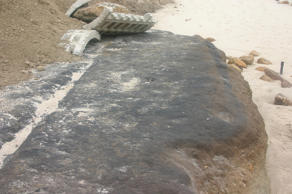
“This has changed the geography of the beach forever,” Southamtpon Town Trustee Jon Semlear said while surveying damage on Friday. “It will never go back to what it was before.” A few hundred feet away, thick natural dunes had been chewed away, exposing several different colored layers of earth. The bottom layer was a spongy mottled material, where former marshlands had turned to peat beneath the sand. Through the peat, two parallel tracks gouged into the material were clearly visible: wagon tracks from the days when the land just behind the dunes was the easiest and straightest way to travel between towns.
“That shows you how the beach is gradually moving northward,” Trustee Frederick Havemeyer said. “That is the way Mother Nature wants to go.”


